You are here: Home > Network List > TA - USArray Transportable Network (new EarthScope stations) Stations List
> Station E21A Keefer Ranch, Vananda, MT, USA > Earthquake Result Viewer
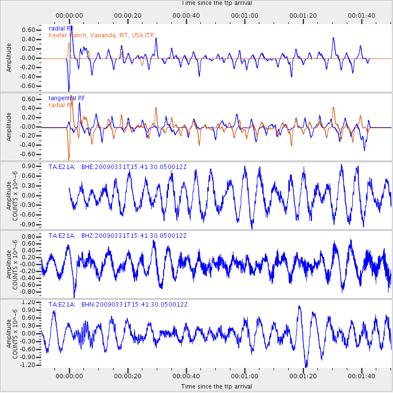
E21A Keefer Ranch, Vananda, MT, USA - Earthquake Result Viewer
*The percent match for this event was below the threshold and hence no stack was calculated.
| Earthquake location: |
Mariana Islands |
| Earthquake latitude/longitude: |
18.3/145.7 |
| Earthquake time(UTC): |
2009/03/31 (090) 15:29:31 GMT |
| Earthquake Depth: |
188 km |
| Earthquake Magnitude: |
5.5 MW, 5.4 MB, 5.4 MW |
| Earthquake Catalog/Contributor: |
WHDF/NEIC |
|
| Network: |
TA USArray Transportable Network (new EarthScope stations) |
| Station: |
E21A Keefer Ranch, Vananda, MT, USA |
| Lat/Lon: |
46.54 N/107.08 W |
| Elevation: |
834 m |
|
| Distance: |
88.2 deg |
| Az: |
41.277 deg |
| Baz: |
294.781 deg |
| Ray Param: |
$rayparam |
*The percent match for this event was below the threshold and hence was not used in the summary stack. |
|
| Radial Match: |
59.00939 % |
| Radial Bump: |
400 |
| Transverse Match: |
71.01292 % |
| Transverse Bump: |
394 |
| SOD ConfigId: |
2658 |
| Insert Time: |
2010-03-06 11:30:24.728 +0000 |
| GWidth: |
2.5 |
| Max Bumps: |
400 |
| Tol: |
0.001 |
|
Signal To Noise
| Channel | StoN | STA | LTA |
| TA:E21A: :BHZ:20090331T15:41:30.050012Z | 1.7641172 | 3.9925595E-7 | 2.2632054E-7 |
| TA:E21A: :BHN:20090331T15:41:30.050012Z | 0.5173984 | 2.3433442E-7 | 4.5290906E-7 |
| TA:E21A: :BHE:20090331T15:41:30.050012Z | 1.2749925 | 3.7010818E-7 | 2.9028266E-7 |
| Arrivals |
| Ps | |
| PpPs | |
| PsPs/PpSs | |


