You are here: Home > Network List > TA - USArray Transportable Network (new EarthScope stations) Stations List
> Station E21A Keefer Ranch, Vananda, MT, USA > Earthquake Result Viewer
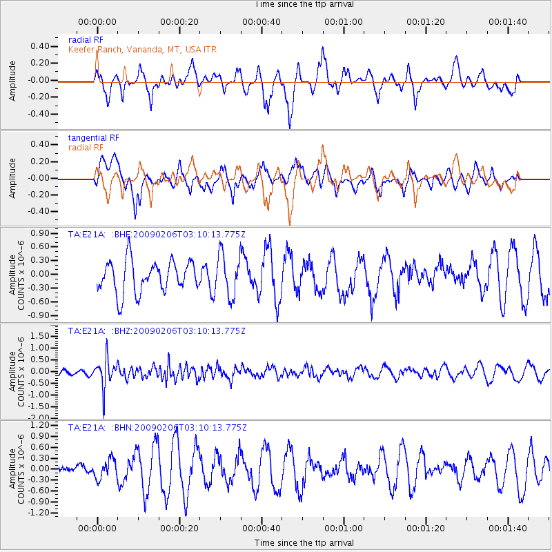
E21A Keefer Ranch, Vananda, MT, USA - Earthquake Result Viewer
*The percent match for this event was below the threshold and hence no stack was calculated.
| Earthquake location: |
Near Coast Of Northern Chile |
| Earthquake latitude/longitude: |
-28.0/-71.1 |
| Earthquake time(UTC): |
2009/02/06 (037) 02:58:35 GMT |
| Earthquake Depth: |
52 km |
| Earthquake Magnitude: |
5.5 MB |
| Earthquake Catalog/Contributor: |
WHDF/NEIC |
|
| Network: |
TA USArray Transportable Network (new EarthScope stations) |
| Station: |
E21A Keefer Ranch, Vananda, MT, USA |
| Lat/Lon: |
46.54 N/107.08 W |
| Elevation: |
834 m |
|
| Distance: |
81.0 deg |
| Az: |
335.764 deg |
| Baz: |
148.27 deg |
| Ray Param: |
$rayparam |
*The percent match for this event was below the threshold and hence was not used in the summary stack. |
|
| Radial Match: |
35.069244 % |
| Radial Bump: |
318 |
| Transverse Match: |
46.51227 % |
| Transverse Bump: |
400 |
| SOD ConfigId: |
2658 |
| Insert Time: |
2010-03-06 11:30:25.965 +0000 |
| GWidth: |
2.5 |
| Max Bumps: |
400 |
| Tol: |
0.001 |
|
Signal To Noise
| Channel | StoN | STA | LTA |
| TA:E21A: :BHZ:20090206T03:10:13.775Z | 2.963754 | 6.169502E-7 | 2.0816513E-7 |
| TA:E21A: :BHN:20090206T03:10:13.775Z | 0.956274 | 2.6664577E-7 | 2.7883823E-7 |
| TA:E21A: :BHE:20090206T03:10:13.775Z | 1.3394454 | 4.657611E-7 | 3.4772688E-7 |
| Arrivals |
| Ps | |
| PpPs | |
| PsPs/PpSs | |


