You are here: Home > Network List > TA - USArray Transportable Network (new EarthScope stations) Stations List
> Station R32K Eaglecrest, AK, USA > Earthquake Result Viewer
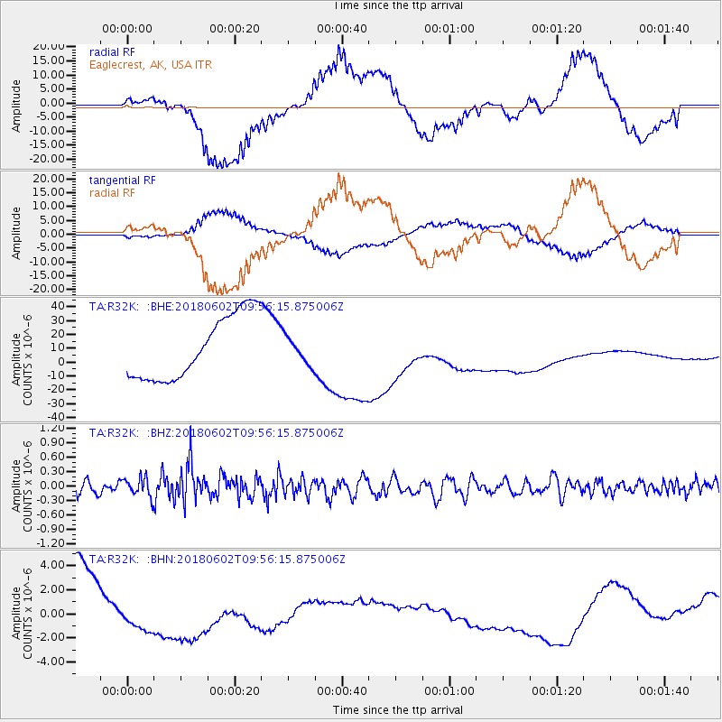
R32K Eaglecrest, AK, USA - Earthquake Result Viewer
*The percent match for this event was below the threshold and hence no stack was calculated.
| Earthquake location: |
East Of Kuril Islands |
| Earthquake latitude/longitude: |
43.9/148.0 |
| Earthquake time(UTC): |
2018/06/02 (153) 09:48:08 GMT |
| Earthquake Depth: |
10 km |
| Earthquake Magnitude: |
5.5 Mww |
| Earthquake Catalog/Contributor: |
NEIC PDE/us |
|
| Network: |
TA USArray Transportable Network (new EarthScope stations) |
| Station: |
R32K Eaglecrest, AK, USA |
| Lat/Lon: |
58.27 N/134.52 W |
| Elevation: |
386 m |
|
| Distance: |
47.9 deg |
| Az: |
44.017 deg |
| Baz: |
288.218 deg |
| Ray Param: |
$rayparam |
*The percent match for this event was below the threshold and hence was not used in the summary stack. |
|
| Radial Match: |
36.020096 % |
| Radial Bump: |
400 |
| Transverse Match: |
42.610718 % |
| Transverse Bump: |
373 |
| SOD ConfigId: |
13570011 |
| Insert Time: |
2019-04-30 08:08:52.062 +0000 |
| GWidth: |
2.5 |
| Max Bumps: |
400 |
| Tol: |
0.001 |
|
Signal To Noise
| Channel | StoN | STA | LTA |
| TA:R32K: :BHZ:20180602T09:56:15.875006Z | 1.5436054 | 2.0392162E-7 | 1.3210735E-7 |
| TA:R32K: :BHN:20180602T09:56:15.875006Z | 0.5659497 | 1.5514091E-6 | 2.7412493E-6 |
| TA:R32K: :BHE:20180602T09:56:15.875006Z | 0.41418466 | 9.510887E-6 | 2.2962913E-5 |
| Arrivals |
| Ps | |
| PpPs | |
| PsPs/PpSs | |


