You are here: Home > Network List > CI - Caltech Regional Seismic Network Stations List
> Station BFS Mt Baldy Forest Station > Earthquake Result Viewer
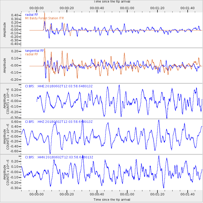
BFS Mt Baldy Forest Station - Earthquake Result Viewer
*The percent match for this event was below the threshold and hence no stack was calculated.
| Earthquake location: |
Samoa Islands Region |
| Earthquake latitude/longitude: |
-14.8/-173.1 |
| Earthquake time(UTC): |
2018/06/02 (153) 11:53:06 GMT |
| Earthquake Depth: |
50 km |
| Earthquake Magnitude: |
5.6 mb |
| Earthquake Catalog/Contributor: |
NEIC PDE/us |
|
| Network: |
CI Caltech Regional Seismic Network |
| Station: |
BFS Mt Baldy Forest Station |
| Lat/Lon: |
34.24 N/117.66 W |
| Elevation: |
1312 m |
|
| Distance: |
71.8 deg |
| Az: |
45.915 deg |
| Baz: |
237.006 deg |
| Ray Param: |
$rayparam |
*The percent match for this event was below the threshold and hence was not used in the summary stack. |
|
| Radial Match: |
70.18057 % |
| Radial Bump: |
400 |
| Transverse Match: |
44.521557 % |
| Transverse Bump: |
400 |
| SOD ConfigId: |
13570011 |
| Insert Time: |
2019-04-30 08:14:01.437 +0000 |
| GWidth: |
2.5 |
| Max Bumps: |
400 |
| Tol: |
0.001 |
|
Signal To Noise
| Channel | StoN | STA | LTA |
| CI:BFS: :HHZ:20180602T12:03:58.648013Z | 0.6097567 | 1.06526194E-7 | 1.7470278E-7 |
| CI:BFS: :HHN:20180602T12:03:58.648013Z | 1.3834822 | 1.3591064E-7 | 9.823808E-8 |
| CI:BFS: :HHE:20180602T12:03:58.648013Z | 0.9159228 | 8.2349175E-8 | 8.9908426E-8 |
| Arrivals |
| Ps | |
| PpPs | |
| PsPs/PpSs | |


