You are here: Home > Network List > TA - USArray Transportable Network (new EarthScope stations) Stations List
> Station F21A Absaloka Mine, Hardin, MT, USA > Earthquake Result Viewer
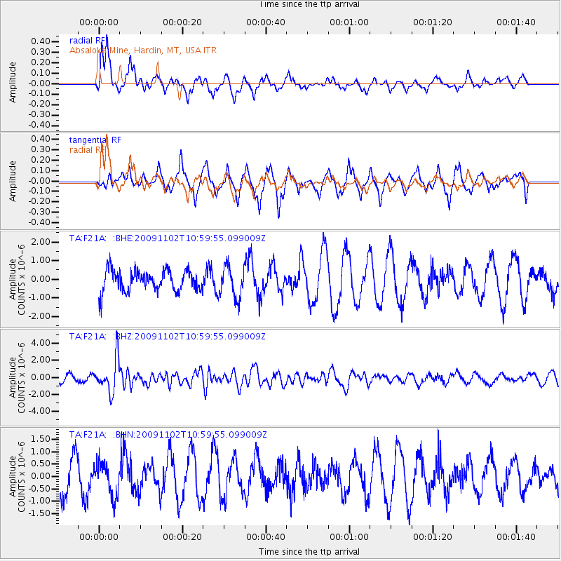
F21A Absaloka Mine, Hardin, MT, USA - Earthquake Result Viewer
*The percent match for this event was below the threshold and hence no stack was calculated.
| Earthquake location: |
South Of Tonga Islands |
| Earthquake latitude/longitude: |
-24.1/-175.2 |
| Earthquake time(UTC): |
2009/11/02 (306) 10:47:13 GMT |
| Earthquake Depth: |
9.0 km |
| Earthquake Magnitude: |
6.1 MB, 6.1 MS, 6.2 MW, 6.1 MW |
| Earthquake Catalog/Contributor: |
WHDF/NEIC |
|
| Network: |
TA USArray Transportable Network (new EarthScope stations) |
| Station: |
F21A Absaloka Mine, Hardin, MT, USA |
| Lat/Lon: |
45.82 N/107.12 W |
| Elevation: |
1026 m |
|
| Distance: |
93.0 deg |
| Az: |
40.501 deg |
| Baz: |
238.06 deg |
| Ray Param: |
$rayparam |
*The percent match for this event was below the threshold and hence was not used in the summary stack. |
|
| Radial Match: |
54.963787 % |
| Radial Bump: |
325 |
| Transverse Match: |
60.802124 % |
| Transverse Bump: |
363 |
| SOD ConfigId: |
2622 |
| Insert Time: |
2010-03-06 11:32:26.149 +0000 |
| GWidth: |
2.5 |
| Max Bumps: |
400 |
| Tol: |
0.001 |
|
Signal To Noise
| Channel | StoN | STA | LTA |
| TA:F21A: :BHZ:20091102T10:59:55.099009Z | 6.610987 | 2.039203E-6 | 3.0845666E-7 |
| TA:F21A: :BHN:20091102T10:59:55.099009Z | 0.9770974 | 6.752096E-7 | 6.910361E-7 |
| TA:F21A: :BHE:20091102T10:59:55.099009Z | 1.4854563 | 8.302311E-7 | 5.5890644E-7 |
| Arrivals |
| Ps | |
| PpPs | |
| PsPs/PpSs | |


