You are here: Home > Network List > TA - USArray Transportable Network (new EarthScope stations) Stations List
> Station F21A Absaloka Mine, Hardin, MT, USA > Earthquake Result Viewer
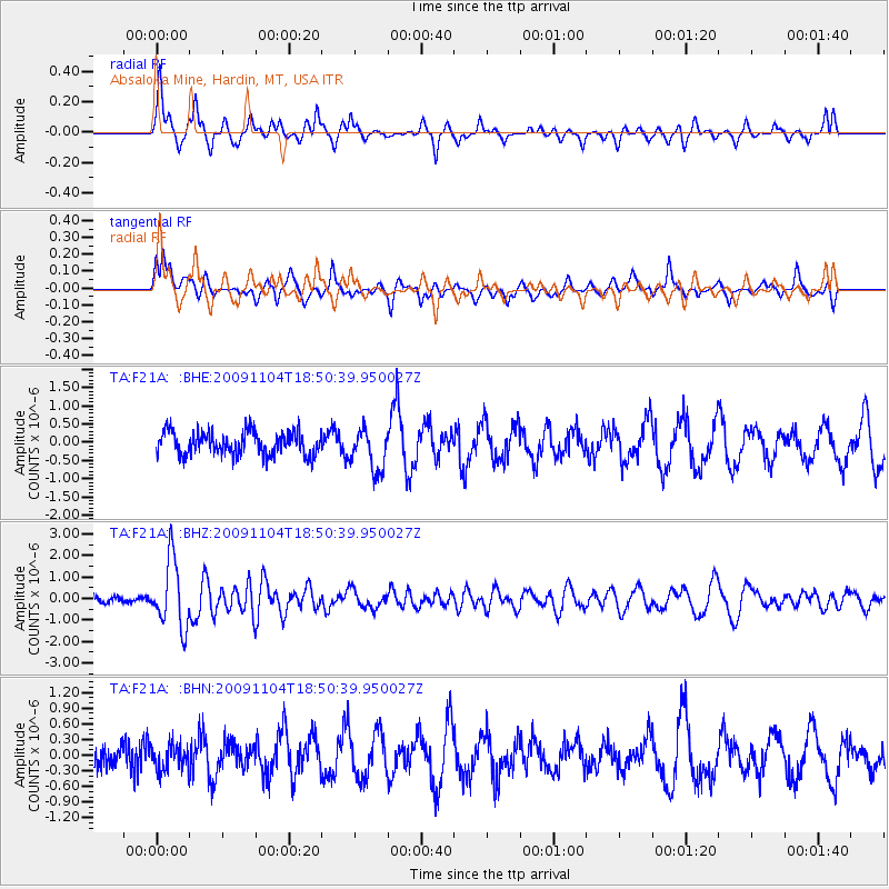
F21A Absaloka Mine, Hardin, MT, USA - Earthquake Result Viewer
*The percent match for this event was below the threshold and hence no stack was calculated.
| Earthquake location: |
Azores Islands Region |
| Earthquake latitude/longitude: |
36.2/-33.9 |
| Earthquake time(UTC): |
2009/11/04 (308) 18:41:44 GMT |
| Earthquake Depth: |
10 km |
| Earthquake Magnitude: |
5.7 MB, 5.6 MS, 5.9 MW, 5.8 MW |
| Earthquake Catalog/Contributor: |
WHDF/NEIC |
|
| Network: |
TA USArray Transportable Network (new EarthScope stations) |
| Station: |
F21A Absaloka Mine, Hardin, MT, USA |
| Lat/Lon: |
45.82 N/107.12 W |
| Elevation: |
1026 m |
|
| Distance: |
54.3 deg |
| Az: |
304.497 deg |
| Baz: |
72.523 deg |
| Ray Param: |
$rayparam |
*The percent match for this event was below the threshold and hence was not used in the summary stack. |
|
| Radial Match: |
66.31158 % |
| Radial Bump: |
317 |
| Transverse Match: |
51.646057 % |
| Transverse Bump: |
358 |
| SOD ConfigId: |
2622 |
| Insert Time: |
2010-03-06 11:32:28.765 +0000 |
| GWidth: |
2.5 |
| Max Bumps: |
400 |
| Tol: |
0.001 |
|
Signal To Noise
| Channel | StoN | STA | LTA |
| TA:F21A: :BHZ:20091104T18:50:39.950027Z | 10.435456 | 1.5657262E-6 | 1.5003907E-7 |
| TA:F21A: :BHN:20091104T18:50:39.950027Z | 0.54881847 | 2.3569004E-7 | 4.294499E-7 |
| TA:F21A: :BHE:20091104T18:50:39.950027Z | 1.7707965 | 5.6179556E-7 | 3.1725585E-7 |
| Arrivals |
| Ps | |
| PpPs | |
| PsPs/PpSs | |


