You are here: Home > Network List > US - United States National Seismic Network Stations List
> Station MNTX Cornudas Mountains, Texas, USA > Earthquake Result Viewer
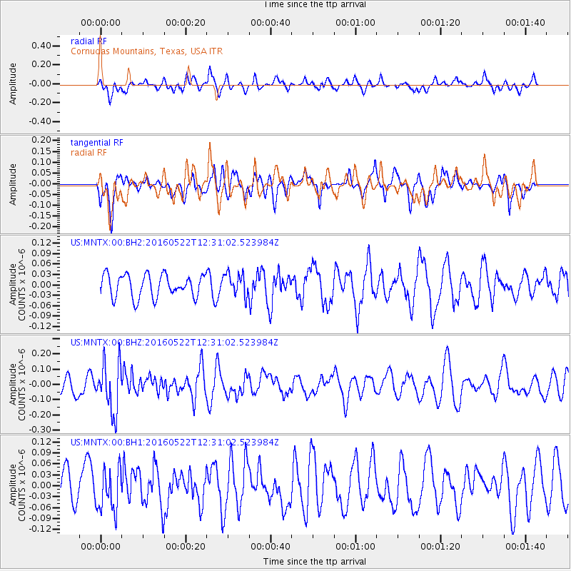
MNTX Cornudas Mountains, Texas, USA - Earthquake Result Viewer
*The percent match for this event was below the threshold and hence no stack was calculated.
| Earthquake location: |
Salta Province, Argentina |
| Earthquake latitude/longitude: |
-22.4/-64.2 |
| Earthquake time(UTC): |
2016/05/22 (143) 12:20:42 GMT |
| Earthquake Depth: |
9.2 km |
| Earthquake Magnitude: |
5.5 MB |
| Earthquake Catalog/Contributor: |
NEIC PDE/NEIC COMCAT |
|
| Network: |
US United States National Seismic Network |
| Station: |
MNTX Cornudas Mountains, Texas, USA |
| Lat/Lon: |
31.70 N/105.38 W |
| Elevation: |
404 m |
|
| Distance: |
66.7 deg |
| Az: |
322.329 deg |
| Baz: |
138.427 deg |
| Ray Param: |
$rayparam |
*The percent match for this event was below the threshold and hence was not used in the summary stack. |
|
| Radial Match: |
59.595882 % |
| Radial Bump: |
400 |
| Transverse Match: |
54.437695 % |
| Transverse Bump: |
400 |
| SOD ConfigId: |
1475611 |
| Insert Time: |
2016-06-05 12:27:13.694 +0000 |
| GWidth: |
2.5 |
| Max Bumps: |
400 |
| Tol: |
0.001 |
|
Signal To Noise
| Channel | StoN | STA | LTA |
| US:MNTX:00:BHZ:20160522T12:31:02.523984Z | 1.8043667 | 1.6426962E-7 | 9.104005E-8 |
| US:MNTX:00:BH1:20160522T12:31:02.523984Z | 1.1980252 | 6.002334E-8 | 5.0101896E-8 |
| US:MNTX:00:BH2:20160522T12:31:02.523984Z | 0.9788558 | 3.1838393E-8 | 3.2526135E-8 |
| Arrivals |
| Ps | |
| PpPs | |
| PsPs/PpSs | |


