You are here: Home > Network List > TA - USArray Transportable Network (new EarthScope stations) Stations List
> Station H16K Elim, AK, USA > Earthquake Result Viewer
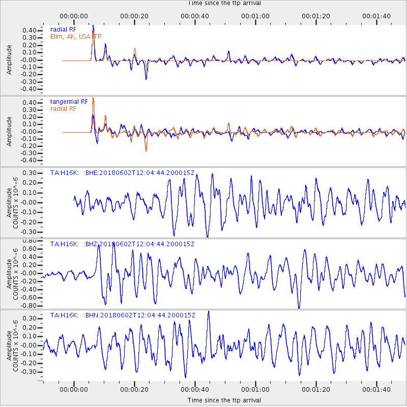
H16K Elim, AK, USA - Earthquake Result Viewer
*The percent match for this event was below the threshold and hence no stack was calculated.
| Earthquake location: |
Samoa Islands Region |
| Earthquake latitude/longitude: |
-14.8/-173.1 |
| Earthquake time(UTC): |
2018/06/02 (153) 11:53:06 GMT |
| Earthquake Depth: |
50 km |
| Earthquake Magnitude: |
5.6 mb |
| Earthquake Catalog/Contributor: |
NEIC PDE/us |
|
| Network: |
TA USArray Transportable Network (new EarthScope stations) |
| Station: |
H16K Elim, AK, USA |
| Lat/Lon: |
64.64 N/162.24 W |
| Elevation: |
216 m |
|
| Distance: |
79.6 deg |
| Az: |
4.736 deg |
| Baz: |
190.687 deg |
| Ray Param: |
$rayparam |
*The percent match for this event was below the threshold and hence was not used in the summary stack. |
|
| Radial Match: |
82.52657 % |
| Radial Bump: |
266 |
| Transverse Match: |
77.91422 % |
| Transverse Bump: |
400 |
| SOD ConfigId: |
13570011 |
| Insert Time: |
2019-04-30 08:19:09.328 +0000 |
| GWidth: |
2.5 |
| Max Bumps: |
400 |
| Tol: |
0.001 |
|
Signal To Noise
| Channel | StoN | STA | LTA |
| TA:H16K: :BHZ:20180602T12:04:44.200015Z | 1.5896748 | 6.6815254E-8 | 4.203077E-8 |
| TA:H16K: :BHN:20180602T12:04:44.200015Z | 1.0360404 | 7.094791E-8 | 6.847987E-8 |
| TA:H16K: :BHE:20180602T12:04:44.200015Z | 1.062498 | 5.663442E-8 | 5.3303083E-8 |
| Arrivals |
| Ps | |
| PpPs | |
| PsPs/PpSs | |


