You are here: Home > Network List > TA - USArray Transportable Network (new EarthScope stations) Stations List
> Station G31M Satah River, YT, CAN > Earthquake Result Viewer
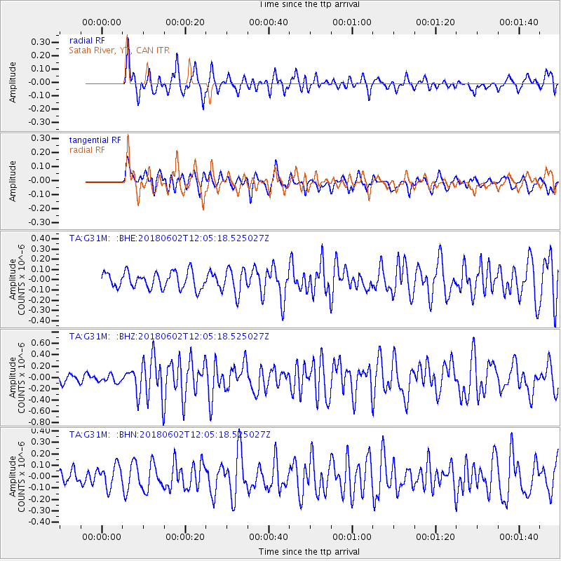
G31M Satah River, YT, CAN - Earthquake Result Viewer
*The percent match for this event was below the threshold and hence no stack was calculated.
| Earthquake location: |
Samoa Islands Region |
| Earthquake latitude/longitude: |
-14.8/-173.1 |
| Earthquake time(UTC): |
2018/06/02 (153) 11:53:06 GMT |
| Earthquake Depth: |
50 km |
| Earthquake Magnitude: |
5.6 mb |
| Earthquake Catalog/Contributor: |
NEIC PDE/us |
|
| Network: |
TA USArray Transportable Network (new EarthScope stations) |
| Station: |
G31M Satah River, YT, CAN |
| Lat/Lon: |
66.92 N/134.27 W |
| Elevation: |
61 m |
|
| Distance: |
86.3 deg |
| Az: |
14.342 deg |
| Baz: |
217.435 deg |
| Ray Param: |
$rayparam |
*The percent match for this event was below the threshold and hence was not used in the summary stack. |
|
| Radial Match: |
79.747955 % |
| Radial Bump: |
400 |
| Transverse Match: |
60.209484 % |
| Transverse Bump: |
400 |
| SOD ConfigId: |
13570011 |
| Insert Time: |
2019-04-30 08:19:09.821 +0000 |
| GWidth: |
2.5 |
| Max Bumps: |
400 |
| Tol: |
0.001 |
|
Signal To Noise
| Channel | StoN | STA | LTA |
| TA:G31M: :BHZ:20180602T12:05:18.525027Z | 1.3171184 | 6.657055E-8 | 5.0542567E-8 |
| TA:G31M: :BHN:20180602T12:05:18.525027Z | 1.2596854 | 1.0020632E-7 | 7.954869E-8 |
| TA:G31M: :BHE:20180602T12:05:18.525027Z | 1.2221457 | 8.4554884E-8 | 6.91856E-8 |
| Arrivals |
| Ps | |
| PpPs | |
| PsPs/PpSs | |


