You are here: Home > Network List > TA - USArray Transportable Network (new EarthScope stations) Stations List
> Station F21A Absaloka Mine, Hardin, MT, USA > Earthquake Result Viewer
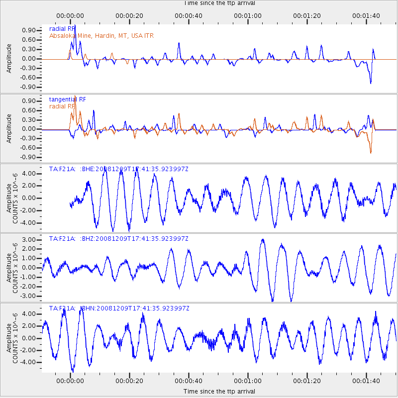
F21A Absaloka Mine, Hardin, MT, USA - Earthquake Result Viewer
*The percent match for this event was below the threshold and hence no stack was calculated.
| Earthquake location: |
Vanuatu Islands |
| Earthquake latitude/longitude: |
-15.9/168.2 |
| Earthquake time(UTC): |
2008/12/09 (344) 17:28:58 GMT |
| Earthquake Depth: |
224 km |
| Earthquake Magnitude: |
5.5 MB, 6.0 MW, 6.0 MW |
| Earthquake Catalog/Contributor: |
WHDF/NEIC |
|
| Network: |
TA USArray Transportable Network (new EarthScope stations) |
| Station: |
F21A Absaloka Mine, Hardin, MT, USA |
| Lat/Lon: |
45.82 N/107.12 W |
| Elevation: |
1026 m |
|
| Distance: |
97.6 deg |
| Az: |
44.63 deg |
| Baz: |
255.139 deg |
| Ray Param: |
$rayparam |
*The percent match for this event was below the threshold and hence was not used in the summary stack. |
|
| Radial Match: |
48.02277 % |
| Radial Bump: |
343 |
| Transverse Match: |
51.98905 % |
| Transverse Bump: |
256 |
| SOD ConfigId: |
2658 |
| Insert Time: |
2010-03-06 11:32:39.748 +0000 |
| GWidth: |
2.5 |
| Max Bumps: |
400 |
| Tol: |
0.001 |
|
Signal To Noise
| Channel | StoN | STA | LTA |
| TA:F21A: :BHZ:20081209T17:41:35.923997Z | 0.19712171 | 2.5386208E-7 | 1.2878443E-6 |
| TA:F21A: :BHN:20081209T17:41:35.923997Z | 2.6383634 | 3.613059E-6 | 1.369432E-6 |
| TA:F21A: :BHE:20081209T17:41:35.923997Z | 0.9152978 | 2.5902534E-6 | 2.8299569E-6 |
| Arrivals |
| Ps | |
| PpPs | |
| PsPs/PpSs | |


