You are here: Home > Network List > TA - USArray Transportable Network (new EarthScope stations) Stations List
> Station J20K Nowitna River, AK, USA > Earthquake Result Viewer
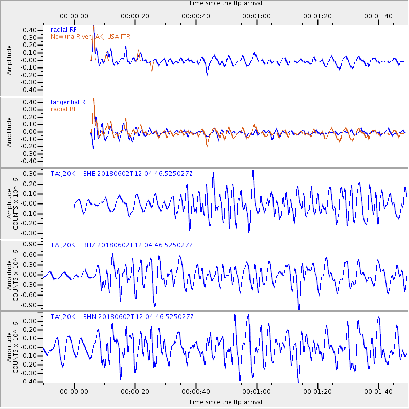
J20K Nowitna River, AK, USA - Earthquake Result Viewer
*The percent match for this event was below the threshold and hence no stack was calculated.
| Earthquake location: |
Samoa Islands Region |
| Earthquake latitude/longitude: |
-14.8/-173.1 |
| Earthquake time(UTC): |
2018/06/02 (153) 11:53:06 GMT |
| Earthquake Depth: |
50 km |
| Earthquake Magnitude: |
5.6 mb |
| Earthquake Catalog/Contributor: |
NEIC PDE/us |
|
| Network: |
TA USArray Transportable Network (new EarthScope stations) |
| Station: |
J20K Nowitna River, AK, USA |
| Lat/Lon: |
64.18 N/154.15 W |
| Elevation: |
314 m |
|
| Distance: |
80.1 deg |
| Az: |
8.307 deg |
| Baz: |
198.609 deg |
| Ray Param: |
$rayparam |
*The percent match for this event was below the threshold and hence was not used in the summary stack. |
|
| Radial Match: |
82.04441 % |
| Radial Bump: |
390 |
| Transverse Match: |
64.63935 % |
| Transverse Bump: |
400 |
| SOD ConfigId: |
13570011 |
| Insert Time: |
2019-04-30 08:19:37.855 +0000 |
| GWidth: |
2.5 |
| Max Bumps: |
400 |
| Tol: |
0.001 |
|
Signal To Noise
| Channel | StoN | STA | LTA |
| TA:J20K: :BHZ:20180602T12:04:46.525027Z | 0.8980048 | 8.284518E-8 | 9.225472E-8 |
| TA:J20K: :BHN:20180602T12:04:46.525027Z | 1.1000143 | 6.791625E-8 | 6.174124E-8 |
| TA:J20K: :BHE:20180602T12:04:46.525027Z | 1.0897666 | 5.2269787E-8 | 4.7964203E-8 |
| Arrivals |
| Ps | |
| PpPs | |
| PsPs/PpSs | |


