You are here: Home > Network List > TA - USArray Transportable Network (new EarthScope stations) Stations List
> Station L15K Ungalak Mountain, AK, USA > Earthquake Result Viewer
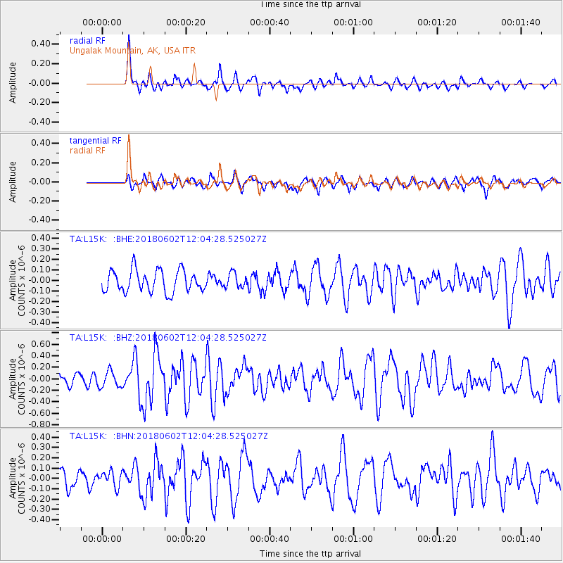
L15K Ungalak Mountain, AK, USA - Earthquake Result Viewer
*The percent match for this event was below the threshold and hence no stack was calculated.
| Earthquake location: |
Samoa Islands Region |
| Earthquake latitude/longitude: |
-14.8/-173.1 |
| Earthquake time(UTC): |
2018/06/02 (153) 11:53:06 GMT |
| Earthquake Depth: |
50 km |
| Earthquake Magnitude: |
5.6 mb |
| Earthquake Catalog/Contributor: |
NEIC PDE/us |
|
| Network: |
TA USArray Transportable Network (new EarthScope stations) |
| Station: |
L15K Ungalak Mountain, AK, USA |
| Lat/Lon: |
61.68 N/161.49 W |
| Elevation: |
219 m |
|
| Distance: |
76.8 deg |
| Az: |
5.664 deg |
| Baz: |
191.547 deg |
| Ray Param: |
$rayparam |
*The percent match for this event was below the threshold and hence was not used in the summary stack. |
|
| Radial Match: |
76.48016 % |
| Radial Bump: |
393 |
| Transverse Match: |
73.68034 % |
| Transverse Bump: |
400 |
| SOD ConfigId: |
13570011 |
| Insert Time: |
2019-04-30 08:19:44.619 +0000 |
| GWidth: |
2.5 |
| Max Bumps: |
400 |
| Tol: |
0.001 |
|
Signal To Noise
| Channel | StoN | STA | LTA |
| TA:L15K: :BHZ:20180602T12:04:28.525027Z | 1.2542416 | 1.441486E-7 | 1.1492889E-7 |
| TA:L15K: :BHN:20180602T12:04:28.525027Z | 0.9254999 | 7.6739155E-8 | 8.2916436E-8 |
| TA:L15K: :BHE:20180602T12:04:28.525027Z | 0.5127921 | 5.546418E-8 | 1.0816114E-7 |
| Arrivals |
| Ps | |
| PpPs | |
| PsPs/PpSs | |


