You are here: Home > Network List > TA - USArray Transportable Network (new EarthScope stations) Stations List
> Station O18K Koktuh Hills, AK, USA > Earthquake Result Viewer
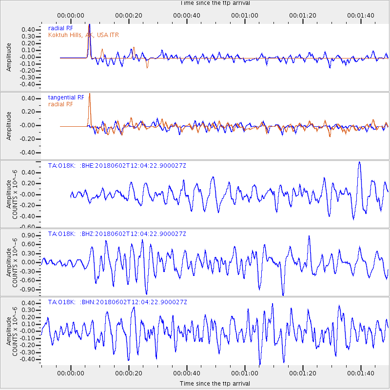
O18K Koktuh Hills, AK, USA - Earthquake Result Viewer
*The percent match for this event was below the threshold and hence no stack was calculated.
| Earthquake location: |
Samoa Islands Region |
| Earthquake latitude/longitude: |
-14.8/-173.1 |
| Earthquake time(UTC): |
2018/06/02 (153) 11:53:06 GMT |
| Earthquake Depth: |
50 km |
| Earthquake Magnitude: |
5.6 mb |
| Earthquake Catalog/Contributor: |
NEIC PDE/us |
|
| Network: |
TA USArray Transportable Network (new EarthScope stations) |
| Station: |
O18K Koktuh Hills, AK, USA |
| Lat/Lon: |
59.85 N/155.21 W |
| Elevation: |
544 m |
|
| Distance: |
75.8 deg |
| Az: |
9.209 deg |
| Baz: |
197.862 deg |
| Ray Param: |
$rayparam |
*The percent match for this event was below the threshold and hence was not used in the summary stack. |
|
| Radial Match: |
77.32365 % |
| Radial Bump: |
400 |
| Transverse Match: |
51.652023 % |
| Transverse Bump: |
400 |
| SOD ConfigId: |
13570011 |
| Insert Time: |
2019-04-30 08:20:10.253 +0000 |
| GWidth: |
2.5 |
| Max Bumps: |
400 |
| Tol: |
0.001 |
|
Signal To Noise
| Channel | StoN | STA | LTA |
| TA:O18K: :BHZ:20180602T12:04:22.900027Z | 1.3481343 | 9.416875E-8 | 6.985117E-8 |
| TA:O18K: :BHN:20180602T12:04:22.900027Z | 0.5906297 | 7.162973E-8 | 1.2127688E-7 |
| TA:O18K: :BHE:20180602T12:04:22.900027Z | 2.428072 | 1.3514911E-7 | 5.5661083E-8 |
| Arrivals |
| Ps | |
| PpPs | |
| PsPs/PpSs | |


