You are here: Home > Network List > UW - Pacific Northwest Regional Seismic Network Stations List
> Station LEBA Lebam, WA, USA > Earthquake Result Viewer
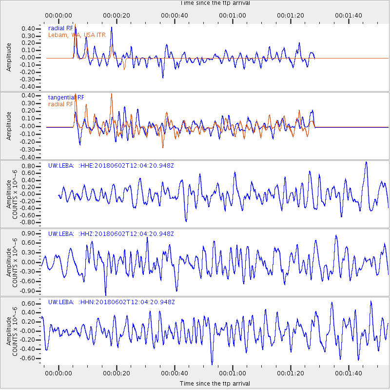
LEBA Lebam, WA, USA - Earthquake Result Viewer
*The percent match for this event was below the threshold and hence no stack was calculated.
| Earthquake location: |
Samoa Islands Region |
| Earthquake latitude/longitude: |
-14.8/-173.1 |
| Earthquake time(UTC): |
2018/06/02 (153) 11:53:06 GMT |
| Earthquake Depth: |
50 km |
| Earthquake Magnitude: |
5.6 mb |
| Earthquake Catalog/Contributor: |
NEIC PDE/us |
|
| Network: |
UW Pacific Northwest Regional Seismic Network |
| Station: |
LEBA Lebam, WA, USA |
| Lat/Lon: |
46.55 N/123.56 W |
| Elevation: |
73 m |
|
| Distance: |
75.5 deg |
| Az: |
32.845 deg |
| Baz: |
229.477 deg |
| Ray Param: |
$rayparam |
*The percent match for this event was below the threshold and hence was not used in the summary stack. |
|
| Radial Match: |
72.530075 % |
| Radial Bump: |
400 |
| Transverse Match: |
53.441433 % |
| Transverse Bump: |
400 |
| SOD ConfigId: |
13570011 |
| Insert Time: |
2019-04-30 08:21:21.444 +0000 |
| GWidth: |
2.5 |
| Max Bumps: |
400 |
| Tol: |
0.001 |
|
Signal To Noise
| Channel | StoN | STA | LTA |
| UW:LEBA: :HHZ:20180602T12:04:20.948Z | 3.270605 | 2.9610155E-7 | 9.053418E-8 |
| UW:LEBA: :HHN:20180602T12:04:20.948Z | 0.37685734 | 5.5746856E-8 | 1.4792563E-7 |
| UW:LEBA: :HHE:20180602T12:04:20.948Z | 2.0709546 | 2.716262E-7 | 1.311599E-7 |
| Arrivals |
| Ps | |
| PpPs | |
| PsPs/PpSs | |


