You are here: Home > Network List > TA - USArray Transportable Network (new EarthScope stations) Stations List
> Station 435B Jarrell, TX, USA > Earthquake Result Viewer
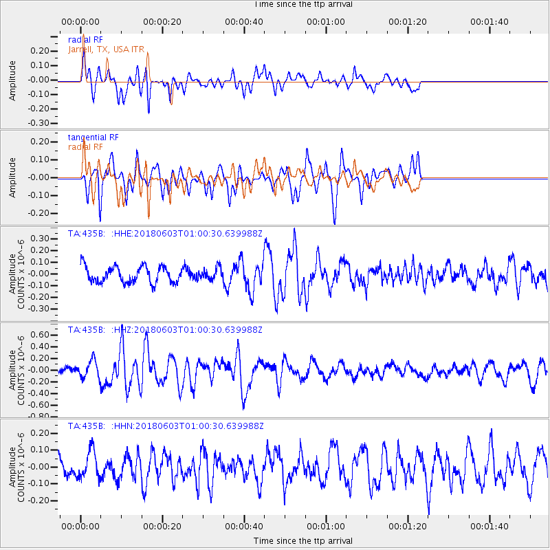
435B Jarrell, TX, USA - Earthquake Result Viewer
*The percent match for this event was below the threshold and hence no stack was calculated.
| Earthquake location: |
Tonga Islands |
| Earthquake latitude/longitude: |
-19.4/-173.7 |
| Earthquake time(UTC): |
2018/06/03 (154) 00:48:09 GMT |
| Earthquake Depth: |
10 km |
| Earthquake Magnitude: |
5.6 mb |
| Earthquake Catalog/Contributor: |
NEIC PDE/us |
|
| Network: |
TA USArray Transportable Network (new EarthScope stations) |
| Station: |
435B Jarrell, TX, USA |
| Lat/Lon: |
30.78 N/97.58 W |
| Elevation: |
248 m |
|
| Distance: |
88.5 deg |
| Az: |
56.69 deg |
| Baz: |
246.43 deg |
| Ray Param: |
$rayparam |
*The percent match for this event was below the threshold and hence was not used in the summary stack. |
|
| Radial Match: |
78.39449 % |
| Radial Bump: |
332 |
| Transverse Match: |
63.781334 % |
| Transverse Bump: |
400 |
| SOD ConfigId: |
13570011 |
| Insert Time: |
2019-04-30 08:33:55.544 +0000 |
| GWidth: |
2.5 |
| Max Bumps: |
400 |
| Tol: |
0.001 |
|
Signal To Noise
| Channel | StoN | STA | LTA |
| TA:435B: :HHZ:20180603T01:00:30.639988Z | 2.379186 | 1.5299521E-7 | 6.4305695E-8 |
| TA:435B: :HHN:20180603T01:00:30.639988Z | 1.367221 | 8.36371E-8 | 6.117306E-8 |
| TA:435B: :HHE:20180603T01:00:30.639988Z | 0.70473415 | 4.952635E-8 | 7.027664E-8 |
| Arrivals |
| Ps | |
| PpPs | |
| PsPs/PpSs | |


