You are here: Home > Network List > TA - USArray Transportable Network (new EarthScope stations) Stations List
> Station H18A Shoshone NF, Cody, WY, USA > Earthquake Result Viewer
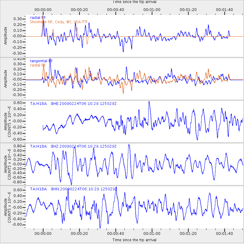
H18A Shoshone NF, Cody, WY, USA - Earthquake Result Viewer
*The percent match for this event was below the threshold and hence no stack was calculated.
| Earthquake location: |
South Of Mariana Islands |
| Earthquake latitude/longitude: |
13.8/146.3 |
| Earthquake time(UTC): |
2009/02/24 (055) 05:57:59 GMT |
| Earthquake Depth: |
5.0 km |
| Earthquake Magnitude: |
5.7 MB, 5.7 MS, 5.9 MW, 5.8 MW |
| Earthquake Catalog/Contributor: |
WHDF/NEIC |
|
| Network: |
TA USArray Transportable Network (new EarthScope stations) |
| Station: |
H18A Shoshone NF, Cody, WY, USA |
| Lat/Lon: |
44.68 N/109.66 W |
| Elevation: |
2221 m |
|
| Distance: |
90.1 deg |
| Az: |
43.802 deg |
| Baz: |
289.51 deg |
| Ray Param: |
$rayparam |
*The percent match for this event was below the threshold and hence was not used in the summary stack. |
|
| Radial Match: |
61.831547 % |
| Radial Bump: |
400 |
| Transverse Match: |
61.776505 % |
| Transverse Bump: |
400 |
| SOD ConfigId: |
2658 |
| Insert Time: |
2010-03-06 11:35:33.118 +0000 |
| GWidth: |
2.5 |
| Max Bumps: |
400 |
| Tol: |
0.001 |
|
Signal To Noise
| Channel | StoN | STA | LTA |
| TA:H18A: :BHZ:20090224T06:10:29.125029Z | 0.77604187 | 1.3868201E-7 | 1.787043E-7 |
| TA:H18A: :BHN:20090224T06:10:29.125029Z | 0.87338525 | 1.2999136E-7 | 1.4883622E-7 |
| TA:H18A: :BHE:20090224T06:10:29.125029Z | 1.0005699 | 1.6410287E-7 | 1.640094E-7 |
| Arrivals |
| Ps | |
| PpPs | |
| PsPs/PpSs | |


