You are here: Home > Network List > TA - USArray Transportable Network (new EarthScope stations) Stations List
> Station G21K Allakaket, AK, USA > Earthquake Result Viewer
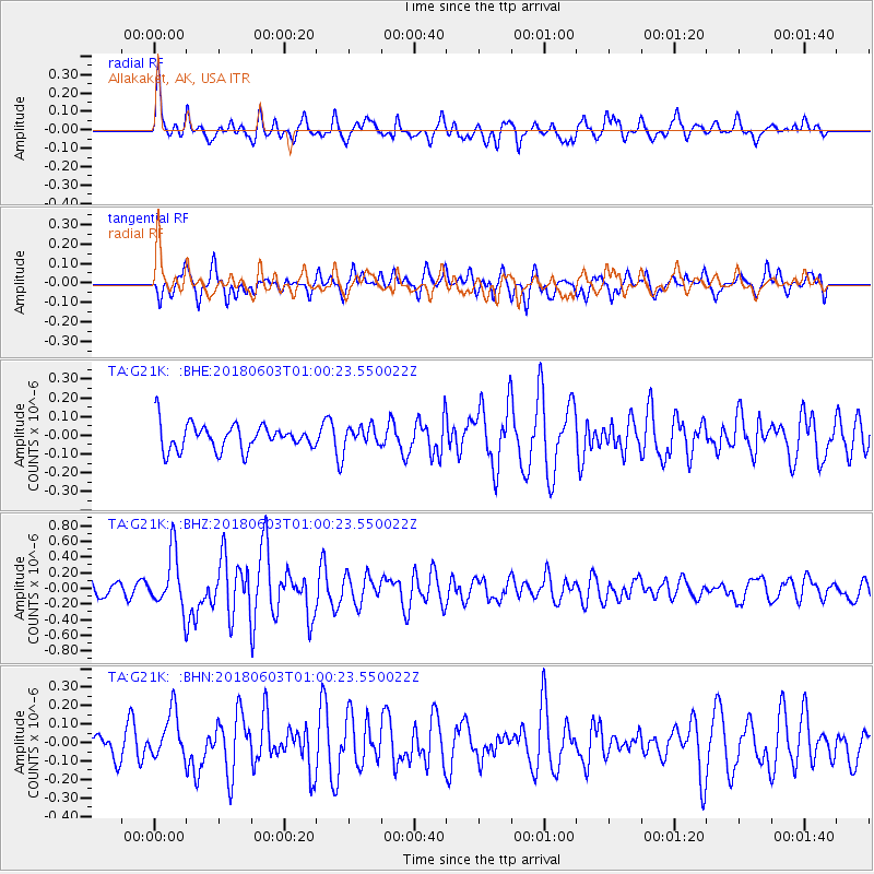
G21K Allakaket, AK, USA - Earthquake Result Viewer
*The percent match for this event was below the threshold and hence no stack was calculated.
| Earthquake location: |
Tonga Islands |
| Earthquake latitude/longitude: |
-19.4/-173.7 |
| Earthquake time(UTC): |
2018/06/03 (154) 00:48:09 GMT |
| Earthquake Depth: |
10 km |
| Earthquake Magnitude: |
5.6 mb |
| Earthquake Catalog/Contributor: |
NEIC PDE/us |
|
| Network: |
TA USArray Transportable Network (new EarthScope stations) |
| Station: |
G21K Allakaket, AK, USA |
| Lat/Lon: |
66.52 N/153.51 W |
| Elevation: |
446 m |
|
| Distance: |
87.0 deg |
| Az: |
7.956 deg |
| Baz: |
199.027 deg |
| Ray Param: |
$rayparam |
*The percent match for this event was below the threshold and hence was not used in the summary stack. |
|
| Radial Match: |
68.857414 % |
| Radial Bump: |
400 |
| Transverse Match: |
63.396088 % |
| Transverse Bump: |
400 |
| SOD ConfigId: |
13570011 |
| Insert Time: |
2019-04-30 08:34:38.845 +0000 |
| GWidth: |
2.5 |
| Max Bumps: |
400 |
| Tol: |
0.001 |
|
Signal To Noise
| Channel | StoN | STA | LTA |
| TA:G21K: :BHZ:20180603T01:00:23.550022Z | 3.0703983 | 3.612129E-7 | 1.1764366E-7 |
| TA:G21K: :BHN:20180603T01:00:23.550022Z | 1.4197121 | 1.2500016E-7 | 8.804613E-8 |
| TA:G21K: :BHE:20180603T01:00:23.550022Z | 1.1298916 | 7.7909355E-8 | 6.895294E-8 |
| Arrivals |
| Ps | |
| PpPs | |
| PsPs/PpSs | |


