You are here: Home > Network List > TA - USArray Transportable Network (new EarthScope stations) Stations List
> Station J20K Nowitna River, AK, USA > Earthquake Result Viewer
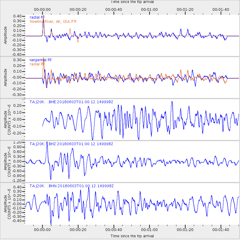
J20K Nowitna River, AK, USA - Earthquake Result Viewer
*The percent match for this event was below the threshold and hence no stack was calculated.
| Earthquake location: |
Tonga Islands |
| Earthquake latitude/longitude: |
-19.4/-173.7 |
| Earthquake time(UTC): |
2018/06/03 (154) 00:48:09 GMT |
| Earthquake Depth: |
10 km |
| Earthquake Magnitude: |
5.6 mb |
| Earthquake Catalog/Contributor: |
NEIC PDE/us |
|
| Network: |
TA USArray Transportable Network (new EarthScope stations) |
| Station: |
J20K Nowitna River, AK, USA |
| Lat/Lon: |
64.18 N/154.15 W |
| Elevation: |
314 m |
|
| Distance: |
84.7 deg |
| Az: |
8.458 deg |
| Baz: |
198.481 deg |
| Ray Param: |
$rayparam |
*The percent match for this event was below the threshold and hence was not used in the summary stack. |
|
| Radial Match: |
68.048904 % |
| Radial Bump: |
385 |
| Transverse Match: |
65.445816 % |
| Transverse Bump: |
400 |
| SOD ConfigId: |
13570011 |
| Insert Time: |
2019-04-30 08:35:06.597 +0000 |
| GWidth: |
2.5 |
| Max Bumps: |
400 |
| Tol: |
0.001 |
|
Signal To Noise
| Channel | StoN | STA | LTA |
| TA:J20K: :BHZ:20180603T01:00:12.149998Z | 7.475631 | 5.3116344E-7 | 7.105265E-8 |
| TA:J20K: :BHN:20180603T01:00:12.149998Z | 1.6951846 | 1.6117149E-7 | 9.5076075E-8 |
| TA:J20K: :BHE:20180603T01:00:12.149998Z | 1.7559294 | 1.4551924E-7 | 8.287306E-8 |
| Arrivals |
| Ps | |
| PpPs | |
| PsPs/PpSs | |


