You are here: Home > Network List > IU - Global Seismograph Network (GSN - IRIS/USGS) Stations List
> Station PMG Port Moresby, New Guinea > Earthquake Result Viewer
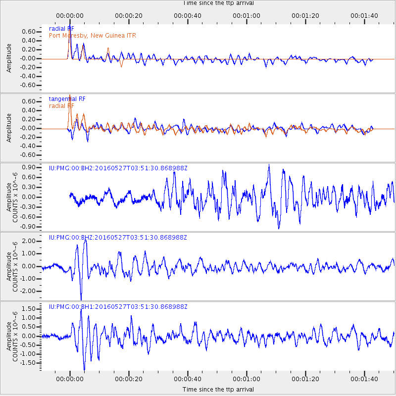
PMG Port Moresby, New Guinea - Earthquake Result Viewer
*The percent match for this event was below the threshold and hence no stack was calculated.
| Earthquake location: |
Southeast Of Ryukyu Islands |
| Earthquake latitude/longitude: |
27.0/130.2 |
| Earthquake time(UTC): |
2016/05/27 (148) 03:44:29 GMT |
| Earthquake Depth: |
10 km |
| Earthquake Magnitude: |
5.8 MO |
| Earthquake Catalog/Contributor: |
NEIC PDE/NEIC ALERT |
|
| Network: |
IU Global Seismograph Network (GSN - IRIS/USGS) |
| Station: |
PMG Port Moresby, New Guinea |
| Lat/Lon: |
9.40 S/147.16 E |
| Elevation: |
90 m |
|
| Distance: |
39.7 deg |
| Az: |
153.236 deg |
| Baz: |
335.969 deg |
| Ray Param: |
$rayparam |
*The percent match for this event was below the threshold and hence was not used in the summary stack. |
|
| Radial Match: |
79.24228 % |
| Radial Bump: |
400 |
| Transverse Match: |
81.48691 % |
| Transverse Bump: |
400 |
| SOD ConfigId: |
1475611 |
| Insert Time: |
2016-06-10 03:47:46.163 +0000 |
| GWidth: |
2.5 |
| Max Bumps: |
400 |
| Tol: |
0.001 |
|
Signal To Noise
| Channel | StoN | STA | LTA |
| IU:PMG:00:BHZ:20160527T03:51:30.868988Z | 8.932189 | 1.10421E-6 | 1.2362143E-7 |
| IU:PMG:00:BH1:20160527T03:51:30.868988Z | 5.947921 | 7.28332E-7 | 1.2245152E-7 |
| IU:PMG:00:BH2:20160527T03:51:30.868988Z | 2.1642513 | 2.6331423E-7 | 1.2166528E-7 |
| Arrivals |
| Ps | |
| PpPs | |
| PsPs/PpSs | |


