You are here: Home > Network List > TA - USArray Transportable Network (new EarthScope stations) Stations List
> Station H18A Shoshone NF, Cody, WY, USA > Earthquake Result Viewer
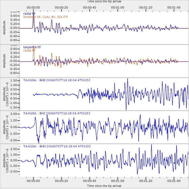
H18A Shoshone NF, Cody, WY, USA - Earthquake Result Viewer
*The percent match for this event was below the threshold and hence no stack was calculated.
| Earthquake location: |
Baffin Bay |
| Earthquake latitude/longitude: |
75.4/-72.5 |
| Earthquake time(UTC): |
2009/07/07 (188) 19:11:46 GMT |
| Earthquake Depth: |
19 km |
| Earthquake Magnitude: |
5.9 MB, 5.7 MS, 6.1 MW, 6.0 MW |
| Earthquake Catalog/Contributor: |
WHDF/NEIC |
|
| Network: |
TA USArray Transportable Network (new EarthScope stations) |
| Station: |
H18A Shoshone NF, Cody, WY, USA |
| Lat/Lon: |
44.68 N/109.66 W |
| Elevation: |
2221 m |
|
| Distance: |
34.7 deg |
| Az: |
229.296 deg |
| Baz: |
15.689 deg |
| Ray Param: |
$rayparam |
*The percent match for this event was below the threshold and hence was not used in the summary stack. |
|
| Radial Match: |
72.84818 % |
| Radial Bump: |
400 |
| Transverse Match: |
72.27924 % |
| Transverse Bump: |
400 |
| SOD ConfigId: |
2648 |
| Insert Time: |
2010-03-06 11:36:01.666 +0000 |
| GWidth: |
2.5 |
| Max Bumps: |
400 |
| Tol: |
0.001 |
|
Signal To Noise
| Channel | StoN | STA | LTA |
| TA:H18A: :BHZ:20090707T19:18:04.475015Z | 15.039327 | 1.1127933E-6 | 7.3992226E-8 |
| TA:H18A: :BHN:20090707T19:18:04.475015Z | 9.563538 | 7.2193166E-7 | 7.5487925E-8 |
| TA:H18A: :BHE:20090707T19:18:04.475015Z | 5.711062 | 2.798566E-7 | 4.900255E-8 |
| Arrivals |
| Ps | |
| PpPs | |
| PsPs/PpSs | |


