You are here: Home > Network List > IW - Intermountain West Stations List
> Station DLMT Dillon, Montana, USA > Earthquake Result Viewer
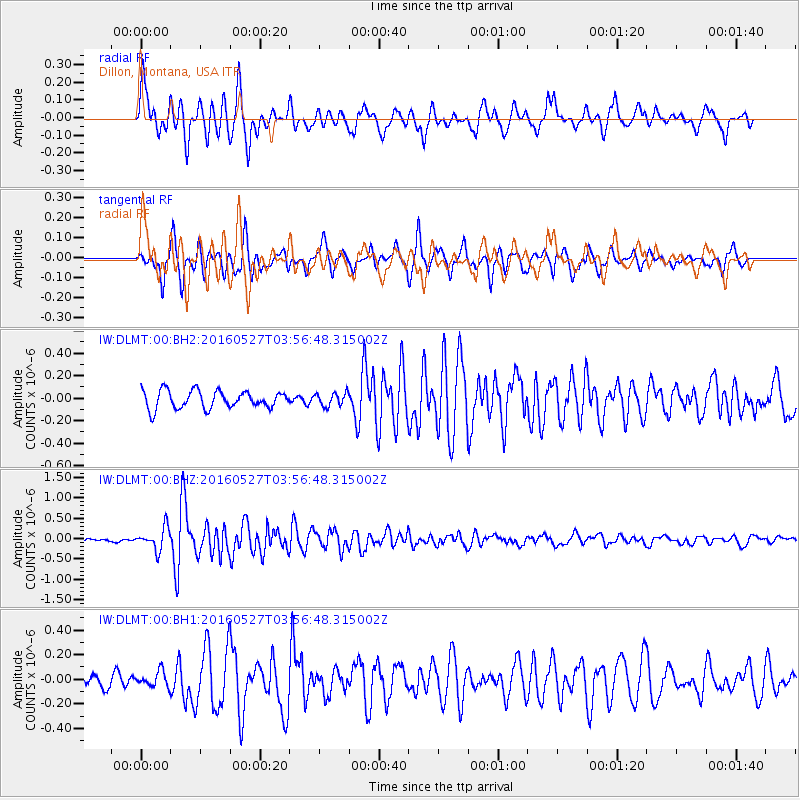
DLMT Dillon, Montana, USA - Earthquake Result Viewer
*The percent match for this event was below the threshold and hence no stack was calculated.
| Earthquake location: |
Southeast Of Ryukyu Islands |
| Earthquake latitude/longitude: |
27.0/130.2 |
| Earthquake time(UTC): |
2016/05/27 (148) 03:44:29 GMT |
| Earthquake Depth: |
10 km |
| Earthquake Magnitude: |
5.8 MO |
| Earthquake Catalog/Contributor: |
NEIC PDE/NEIC ALERT |
|
| Network: |
IW Intermountain West |
| Station: |
DLMT Dillon, Montana, USA |
| Lat/Lon: |
45.36 N/112.60 W |
| Elevation: |
1569 m |
|
| Distance: |
88.1 deg |
| Az: |
38.853 deg |
| Baz: |
307.437 deg |
| Ray Param: |
$rayparam |
*The percent match for this event was below the threshold and hence was not used in the summary stack. |
|
| Radial Match: |
79.56639 % |
| Radial Bump: |
368 |
| Transverse Match: |
82.654434 % |
| Transverse Bump: |
389 |
| SOD ConfigId: |
1475611 |
| Insert Time: |
2016-06-10 03:48:11.564 +0000 |
| GWidth: |
2.5 |
| Max Bumps: |
400 |
| Tol: |
0.001 |
|
Signal To Noise
| Channel | StoN | STA | LTA |
| IW:DLMT:00:BHZ:20160527T03:56:48.315002Z | 4.287746 | 2.69601E-7 | 6.28771E-8 |
| IW:DLMT:00:BH1:20160527T03:56:48.315002Z | 1.3491088 | 6.324964E-8 | 4.688253E-8 |
| IW:DLMT:00:BH2:20160527T03:56:48.315002Z | 0.7550957 | 5.9073567E-8 | 7.8233214E-8 |
| Arrivals |
| Ps | |
| PpPs | |
| PsPs/PpSs | |


