You are here: Home > Network List > IW - Intermountain West Stations List
> Station MOOW Moose Ponds, Wyoming, USA > Earthquake Result Viewer
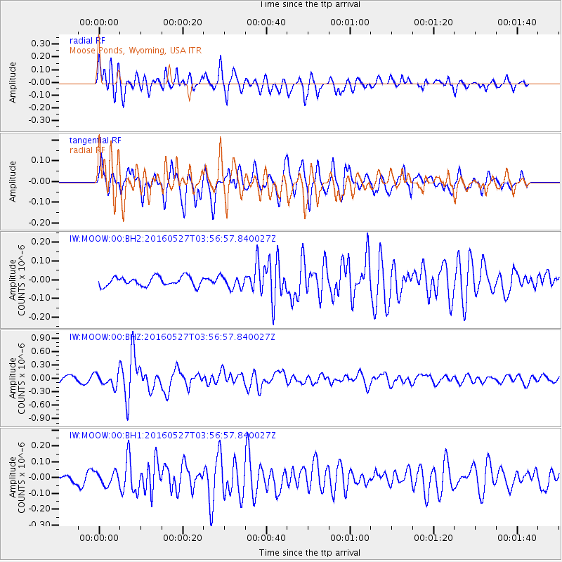
MOOW Moose Ponds, Wyoming, USA - Earthquake Result Viewer
*The percent match for this event was below the threshold and hence no stack was calculated.
| Earthquake location: |
Southeast Of Ryukyu Islands |
| Earthquake latitude/longitude: |
27.0/130.2 |
| Earthquake time(UTC): |
2016/05/27 (148) 03:44:29 GMT |
| Earthquake Depth: |
10 km |
| Earthquake Magnitude: |
5.8 MO |
| Earthquake Catalog/Contributor: |
NEIC PDE/NEIC ALERT |
|
| Network: |
IW Intermountain West |
| Station: |
MOOW Moose Ponds, Wyoming, USA |
| Lat/Lon: |
43.75 N/110.74 W |
| Elevation: |
2128 m |
|
| Distance: |
90.2 deg |
| Az: |
39.306 deg |
| Baz: |
308.739 deg |
| Ray Param: |
$rayparam |
*The percent match for this event was below the threshold and hence was not used in the summary stack. |
|
| Radial Match: |
86.38784 % |
| Radial Bump: |
400 |
| Transverse Match: |
77.68092 % |
| Transverse Bump: |
400 |
| SOD ConfigId: |
1475611 |
| Insert Time: |
2016-06-10 03:48:31.456 +0000 |
| GWidth: |
2.5 |
| Max Bumps: |
400 |
| Tol: |
0.001 |
|
Signal To Noise
| Channel | StoN | STA | LTA |
| IW:MOOW:00:BHZ:20160527T03:56:57.840027Z | 2.31652 | 1.4740719E-7 | 6.363304E-8 |
| IW:MOOW:00:BH1:20160527T03:56:57.840027Z | 1.361164 | 4.058069E-8 | 2.981323E-8 |
| IW:MOOW:00:BH2:20160527T03:56:57.840027Z | 1.3129473 | 3.1876464E-8 | 2.4278556E-8 |
| Arrivals |
| Ps | |
| PpPs | |
| PsPs/PpSs | |


