You are here: Home > Network List > TA - USArray Transportable Network (new EarthScope stations) Stations List
> Station D19A Cripps Ranch, Grass Range, MT, USA > Earthquake Result Viewer
D19A Cripps Ranch, Grass Range, MT, USA - Earthquake Result Viewer

| Earthquake location: |
Southeast Of Honshu, Japan |
| Earthquake latitude/longitude: |
32.8/140.4 |
| Earthquake time(UTC): |
2009/08/12 (224) 22:48:51 GMT |
| Earthquake Depth: |
53 km |
| Earthquake Magnitude: |
6.2 MB, 6.6 MW, 6.6 MW |
| Earthquake Catalog/Contributor: |
WHDF/NEIC |
|
| Network: |
TA USArray Transportable Network (new EarthScope stations) |
| Station: |
D19A Cripps Ranch, Grass Range, MT, USA |
| Lat/Lon: |
47.16 N/108.88 W |
| Elevation: |
1047 m |
|
| Distance: |
79.0 deg |
| Az: |
40.554 deg |
| Baz: |
306.649 deg |
| Ray Param: |
0.049171384 |
| Estimated Moho Depth: |
38.5 km |
| Estimated Crust Vp/Vs: |
2.01 |
| Assumed Crust Vp: |
6.518 km/s |
| Estimated Crust Vs: |
3.247 km/s |
| Estimated Crust Poisson's Ratio: |
0.33 |
|
| Radial Match: |
96.09638 % |
| Radial Bump: |
400 |
| Transverse Match: |
87.2577 % |
| Transverse Bump: |
400 |
| SOD ConfigId: |
2622 |
| Insert Time: |
2010-03-06 11:37:01.597 +0000 |
| GWidth: |
2.5 |
| Max Bumps: |
400 |
| Tol: |
0.001 |
|
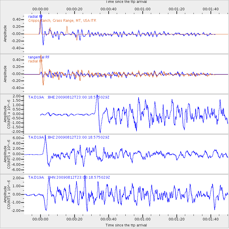
Signal To Noise
| Channel | StoN | STA | LTA |
| TA:D19A: :BHZ:20090812T23:00:18.575029Z | 58.975616 | 2.9171642E-6 | 4.9463903E-8 |
| TA:D19A: :BHN:20090812T23:00:18.575029Z | 12.679708 | 9.3715636E-7 | 7.390993E-8 |
| TA:D19A: :BHE:20090812T23:00:18.575029Z | 13.711038 | 1.0093916E-6 | 7.36189E-8 |
| Arrivals |
| Ps | 6.1 SECOND |
| PpPs | 17 SECOND |
| PsPs/PpSs | 23 SECOND |


