You are here: Home > Network List > CN - Canadian National Seismograph Network Stations List
> Station INK INUVIK, NT > Earthquake Result Viewer
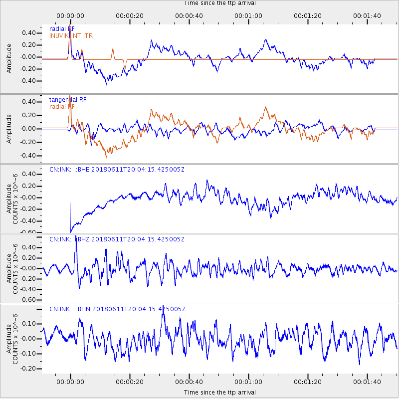
INK INUVIK, NT - Earthquake Result Viewer
*The percent match for this event was below the threshold and hence no stack was calculated.
| Earthquake location: |
Kyushu, Japan |
| Earthquake latitude/longitude: |
31.3/131.5 |
| Earthquake time(UTC): |
2018/06/11 (162) 19:54:21 GMT |
| Earthquake Depth: |
34 km |
| Earthquake Magnitude: |
5.4 Mww |
| Earthquake Catalog/Contributor: |
NEIC PDE/us |
|
| Network: |
CN Canadian National Seismograph Network |
| Station: |
INK INUVIK, NT |
| Lat/Lon: |
68.31 N/133.53 W |
| Elevation: |
44 m |
|
| Distance: |
63.1 deg |
| Az: |
24.527 deg |
| Baz: |
287.035 deg |
| Ray Param: |
$rayparam |
*The percent match for this event was below the threshold and hence was not used in the summary stack. |
|
| Radial Match: |
26.02267 % |
| Radial Bump: |
400 |
| Transverse Match: |
37.276707 % |
| Transverse Bump: |
400 |
| SOD ConfigId: |
13570011 |
| Insert Time: |
2019-04-30 08:43:33.407 +0000 |
| GWidth: |
2.5 |
| Max Bumps: |
400 |
| Tol: |
0.001 |
|
Signal To Noise
| Channel | StoN | STA | LTA |
| CN:INK: :BHZ:20180611T20:04:15.425005Z | 4.793307 | 2.3419776E-7 | 4.8859327E-8 |
| CN:INK: :BHN:20180611T20:04:15.425005Z | 1.8267105 | 7.6230755E-8 | 4.1731166E-8 |
| CN:INK: :BHE:20180611T20:04:15.425005Z | 1.2401727 | 2.247817E-7 | 1.8125033E-7 |
| Arrivals |
| Ps | |
| PpPs | |
| PsPs/PpSs | |


