You are here: Home > Network List > US - United States National Seismic Network Stations List
> Station ELK Elko, Nevada, USA > Earthquake Result Viewer
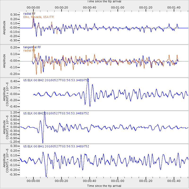
ELK Elko, Nevada, USA - Earthquake Result Viewer
*The percent match for this event was below the threshold and hence no stack was calculated.
| Earthquake location: |
Southeast Of Ryukyu Islands |
| Earthquake latitude/longitude: |
27.0/130.2 |
| Earthquake time(UTC): |
2016/05/27 (148) 03:44:29 GMT |
| Earthquake Depth: |
10 km |
| Earthquake Magnitude: |
5.8 MO |
| Earthquake Catalog/Contributor: |
NEIC PDE/NEIC ALERT |
|
| Network: |
US United States National Seismic Network |
| Station: |
ELK Elko, Nevada, USA |
| Lat/Lon: |
40.74 N/115.24 W |
| Elevation: |
2210 m |
|
| Distance: |
89.3 deg |
| Az: |
43.714 deg |
| Baz: |
305.745 deg |
| Ray Param: |
$rayparam |
*The percent match for this event was below the threshold and hence was not used in the summary stack. |
|
| Radial Match: |
73.41434 % |
| Radial Bump: |
341 |
| Transverse Match: |
77.741295 % |
| Transverse Bump: |
400 |
| SOD ConfigId: |
1475611 |
| Insert Time: |
2016-06-10 03:50:23.722 +0000 |
| GWidth: |
2.5 |
| Max Bumps: |
400 |
| Tol: |
0.001 |
|
Signal To Noise
| Channel | StoN | STA | LTA |
| US:ELK:00:BHZ:20160527T03:56:53.948975Z | 2.8047419 | 2.1130866E-7 | 7.533979E-8 |
| US:ELK:00:BH1:20160527T03:56:53.948975Z | 0.790536 | 3.4841584E-8 | 4.407337E-8 |
| US:ELK:00:BH2:20160527T03:56:53.948975Z | 1.3320647 | 5.398127E-8 | 4.0524508E-8 |
| Arrivals |
| Ps | |
| PpPs | |
| PsPs/PpSs | |


