You are here: Home > Network List > TA - USArray Transportable Network (new EarthScope stations) Stations List
> Station I23K Minto, Yukon-Koyukuk, AK, USA > Earthquake Result Viewer
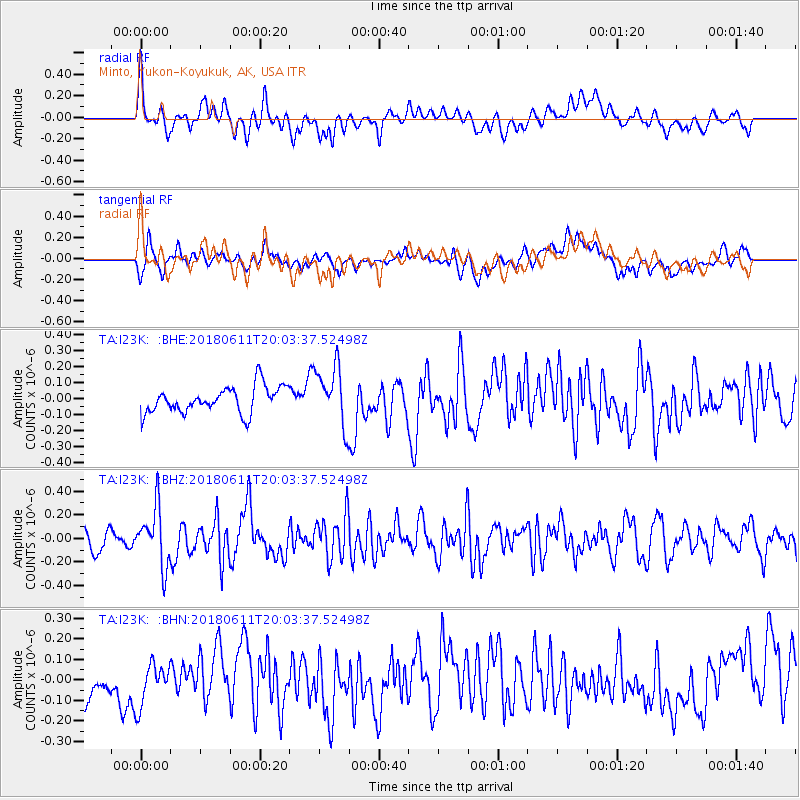
I23K Minto, Yukon-Koyukuk, AK, USA - Earthquake Result Viewer
*The percent match for this event was below the threshold and hence no stack was calculated.
| Earthquake location: |
Kyushu, Japan |
| Earthquake latitude/longitude: |
31.3/131.5 |
| Earthquake time(UTC): |
2018/06/11 (162) 19:54:21 GMT |
| Earthquake Depth: |
34 km |
| Earthquake Magnitude: |
5.4 Mww |
| Earthquake Catalog/Contributor: |
NEIC PDE/us |
|
| Network: |
TA USArray Transportable Network (new EarthScope stations) |
| Station: |
I23K Minto, Yukon-Koyukuk, AK, USA |
| Lat/Lon: |
65.15 N/149.36 W |
| Elevation: |
149 m |
|
| Distance: |
57.6 deg |
| Az: |
29.452 deg |
| Baz: |
274.923 deg |
| Ray Param: |
$rayparam |
*The percent match for this event was below the threshold and hence was not used in the summary stack. |
|
| Radial Match: |
49.234722 % |
| Radial Bump: |
400 |
| Transverse Match: |
47.652782 % |
| Transverse Bump: |
400 |
| SOD ConfigId: |
13570011 |
| Insert Time: |
2019-04-30 08:48:12.884 +0000 |
| GWidth: |
2.5 |
| Max Bumps: |
400 |
| Tol: |
0.001 |
|
Signal To Noise
| Channel | StoN | STA | LTA |
| TA:I23K: :BHZ:20180611T20:03:37.52498Z | 2.7036278 | 2.4468386E-7 | 9.050205E-8 |
| TA:I23K: :BHN:20180611T20:03:37.52498Z | 0.9430107 | 1.0658201E-7 | 1.1302312E-7 |
| TA:I23K: :BHE:20180611T20:03:37.52498Z | 2.27812 | 1.8832503E-7 | 8.2666865E-8 |
| Arrivals |
| Ps | |
| PpPs | |
| PsPs/PpSs | |


