You are here: Home > Network List > TA - USArray Transportable Network (new EarthScope stations) Stations List
> Station J26L Joseph Creek, AK, USA > Earthquake Result Viewer
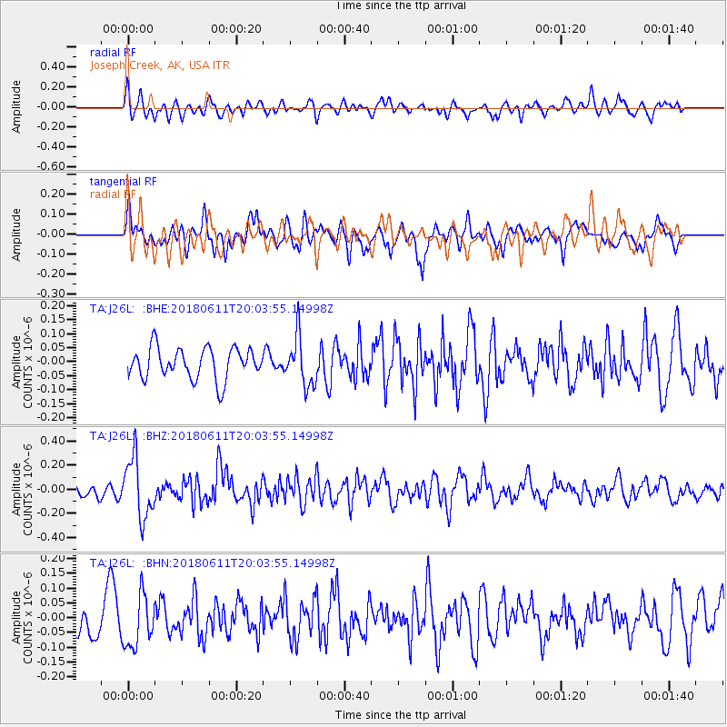
J26L Joseph Creek, AK, USA - Earthquake Result Viewer
*The percent match for this event was below the threshold and hence no stack was calculated.
| Earthquake location: |
Kyushu, Japan |
| Earthquake latitude/longitude: |
31.3/131.5 |
| Earthquake time(UTC): |
2018/06/11 (162) 19:54:21 GMT |
| Earthquake Depth: |
34 km |
| Earthquake Magnitude: |
5.4 Mww |
| Earthquake Catalog/Contributor: |
NEIC PDE/us |
|
| Network: |
TA USArray Transportable Network (new EarthScope stations) |
| Station: |
J26L Joseph Creek, AK, USA |
| Lat/Lon: |
64.50 N/143.56 W |
| Elevation: |
1144 m |
|
| Distance: |
60.1 deg |
| Az: |
29.819 deg |
| Baz: |
280.353 deg |
| Ray Param: |
$rayparam |
*The percent match for this event was below the threshold and hence was not used in the summary stack. |
|
| Radial Match: |
56.63094 % |
| Radial Bump: |
400 |
| Transverse Match: |
48.364483 % |
| Transverse Bump: |
395 |
| SOD ConfigId: |
13570011 |
| Insert Time: |
2019-04-30 08:48:19.873 +0000 |
| GWidth: |
2.5 |
| Max Bumps: |
400 |
| Tol: |
0.001 |
|
Signal To Noise
| Channel | StoN | STA | LTA |
| TA:J26L: :BHZ:20180611T20:03:55.14998Z | 3.8582864 | 2.501254E-7 | 6.482811E-8 |
| TA:J26L: :BHN:20180611T20:03:55.14998Z | 1.7794741 | 8.866742E-8 | 4.982788E-8 |
| TA:J26L: :BHE:20180611T20:03:55.14998Z | 1.5991743 | 8.833304E-8 | 5.5236654E-8 |
| Arrivals |
| Ps | |
| PpPs | |
| PsPs/PpSs | |


