You are here: Home > Network List > TA - USArray Transportable Network (new EarthScope stations) Stations List
> Station O18K Koktuh Hills, AK, USA > Earthquake Result Viewer
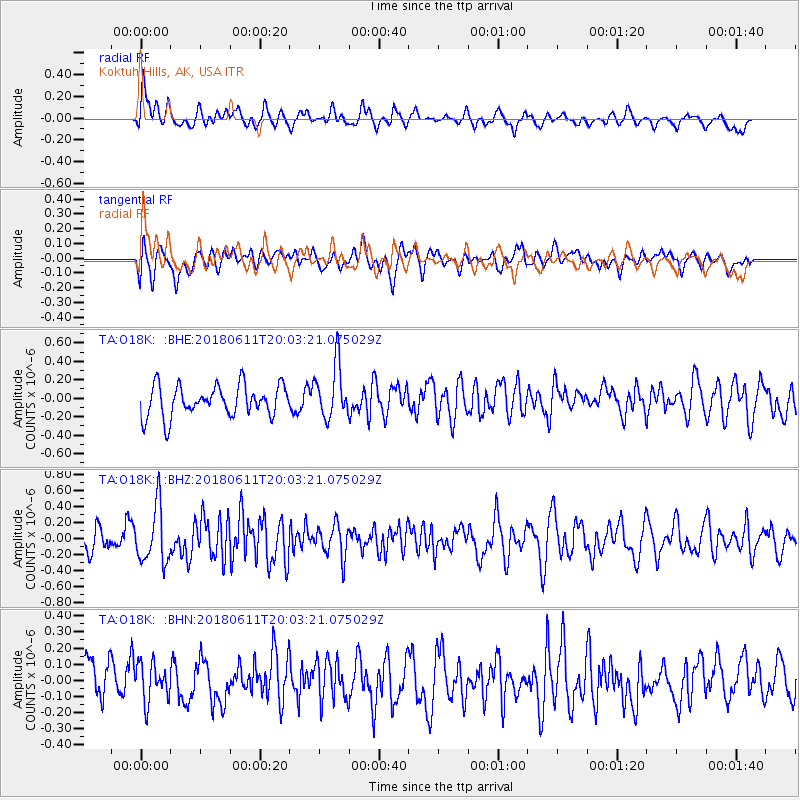
O18K Koktuh Hills, AK, USA - Earthquake Result Viewer
*The percent match for this event was below the threshold and hence no stack was calculated.
| Earthquake location: |
Kyushu, Japan |
| Earthquake latitude/longitude: |
31.3/131.5 |
| Earthquake time(UTC): |
2018/06/11 (162) 19:54:21 GMT |
| Earthquake Depth: |
34 km |
| Earthquake Magnitude: |
5.4 Mww |
| Earthquake Catalog/Contributor: |
NEIC PDE/us |
|
| Network: |
TA USArray Transportable Network (new EarthScope stations) |
| Station: |
O18K Koktuh Hills, AK, USA |
| Lat/Lon: |
59.85 N/155.21 W |
| Elevation: |
544 m |
|
| Distance: |
55.3 deg |
| Az: |
36.043 deg |
| Baz: |
273.386 deg |
| Ray Param: |
$rayparam |
*The percent match for this event was below the threshold and hence was not used in the summary stack. |
|
| Radial Match: |
58.68855 % |
| Radial Bump: |
400 |
| Transverse Match: |
54.092995 % |
| Transverse Bump: |
400 |
| SOD ConfigId: |
13570011 |
| Insert Time: |
2019-04-30 08:48:55.675 +0000 |
| GWidth: |
2.5 |
| Max Bumps: |
400 |
| Tol: |
0.001 |
|
Signal To Noise
| Channel | StoN | STA | LTA |
| TA:O18K: :BHZ:20180611T20:03:21.075029Z | 2.2247903 | 3.5113175E-7 | 1.578269E-7 |
| TA:O18K: :BHN:20180611T20:03:21.075029Z | 0.9059199 | 1.1657669E-7 | 1.2868323E-7 |
| TA:O18K: :BHE:20180611T20:03:21.075029Z | 1.7576343 | 2.9332176E-7 | 1.668844E-7 |
| Arrivals |
| Ps | |
| PpPs | |
| PsPs/PpSs | |


