You are here: Home > Network List > TA - USArray Transportable Network (new EarthScope stations) Stations List
> Station F26K Sheenjek River, AK, USA > Earthquake Result Viewer
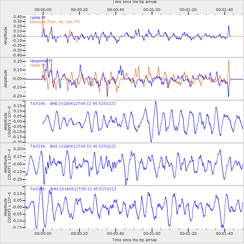
F26K Sheenjek River, AK, USA - Earthquake Result Viewer
*The percent match for this event was below the threshold and hence no stack was calculated.
| Earthquake location: |
New Britain Region, P.N.G. |
| Earthquake latitude/longitude: |
-5.6/150.3 |
| Earthquake time(UTC): |
2018/06/12 (163) 06:20:49 GMT |
| Earthquake Depth: |
121 km |
| Earthquake Magnitude: |
5.3 Mww |
| Earthquake Catalog/Contributor: |
NEIC PDE/us |
|
| Network: |
TA USArray Transportable Network (new EarthScope stations) |
| Station: |
F26K Sheenjek River, AK, USA |
| Lat/Lon: |
67.69 N/144.15 W |
| Elevation: |
683 m |
|
| Distance: |
86.1 deg |
| Az: |
20.389 deg |
| Baz: |
245.282 deg |
| Ray Param: |
$rayparam |
*The percent match for this event was below the threshold and hence was not used in the summary stack. |
|
| Radial Match: |
57.846462 % |
| Radial Bump: |
400 |
| Transverse Match: |
53.1973 % |
| Transverse Bump: |
400 |
| SOD ConfigId: |
13570011 |
| Insert Time: |
2019-04-30 08:54:22.202 +0000 |
| GWidth: |
2.5 |
| Max Bumps: |
400 |
| Tol: |
0.001 |
|
Signal To Noise
| Channel | StoN | STA | LTA |
| TA:F26K: :BHZ:20180612T06:32:45.525022Z | 1.4522985 | 1.1155484E-7 | 7.681261E-8 |
| TA:F26K: :BHN:20180612T06:32:45.525022Z | 3.8132977 | 1.0055274E-7 | 2.6368971E-8 |
| TA:F26K: :BHE:20180612T06:32:45.525022Z | 1.3723174 | 6.061588E-8 | 4.4170452E-8 |
| Arrivals |
| Ps | |
| PpPs | |
| PsPs/PpSs | |


