You are here: Home > Network List > TA - USArray Transportable Network (new EarthScope stations) Stations List
> Station E18K Tukpahlearik Creek, AK, USA > Earthquake Result Viewer
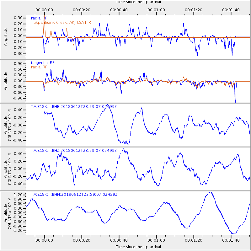
E18K Tukpahlearik Creek, AK, USA - Earthquake Result Viewer
*The percent match for this event was below the threshold and hence no stack was calculated.
| Earthquake location: |
Southern Sumatra, Indonesia |
| Earthquake latitude/longitude: |
-1.9/98.7 |
| Earthquake time(UTC): |
2018/06/12 (163) 23:46:12 GMT |
| Earthquake Depth: |
12 km |
| Earthquake Magnitude: |
5.1 Mww |
| Earthquake Catalog/Contributor: |
NEIC PDE/us |
|
| Network: |
TA USArray Transportable Network (new EarthScope stations) |
| Station: |
E18K Tukpahlearik Creek, AK, USA |
| Lat/Lon: |
67.42 N/160.60 W |
| Elevation: |
297 m |
|
| Distance: |
95.9 deg |
| Az: |
22.423 deg |
| Baz: |
279.168 deg |
| Ray Param: |
$rayparam |
*The percent match for this event was below the threshold and hence was not used in the summary stack. |
|
| Radial Match: |
46.50149 % |
| Radial Bump: |
311 |
| Transverse Match: |
61.92771 % |
| Transverse Bump: |
258 |
| SOD ConfigId: |
13570011 |
| Insert Time: |
2019-04-30 09:02:00.377 +0000 |
| GWidth: |
2.5 |
| Max Bumps: |
400 |
| Tol: |
0.001 |
|
Signal To Noise
| Channel | StoN | STA | LTA |
| TA:E18K: :BHZ:20180612T23:59:07.02499Z | 0.6218689 | 1.0583568E-7 | 1.701897E-7 |
| TA:E18K: :BHN:20180612T23:59:07.02499Z | 0.6906511 | 3.483697E-7 | 5.0440764E-7 |
| TA:E18K: :BHE:20180612T23:59:07.02499Z | 2.2981527 | 4.4290684E-7 | 1.9272298E-7 |
| Arrivals |
| Ps | |
| PpPs | |
| PsPs/PpSs | |


