You are here: Home > Network List > TA - USArray Transportable Network (new EarthScope stations) Stations List
> Station C16K Lisburne Hills, AK, USA > Earthquake Result Viewer
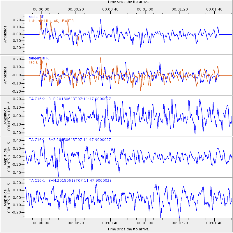
C16K Lisburne Hills, AK, USA - Earthquake Result Viewer
*The percent match for this event was below the threshold and hence no stack was calculated.
| Earthquake location: |
Southern Sumatra, Indonesia |
| Earthquake latitude/longitude: |
-1.9/98.7 |
| Earthquake time(UTC): |
2018/06/13 (164) 06:59:01 GMT |
| Earthquake Depth: |
10 km |
| Earthquake Magnitude: |
5.4 Mww |
| Earthquake Catalog/Contributor: |
NEIC PDE/us |
|
| Network: |
TA USArray Transportable Network (new EarthScope stations) |
| Station: |
C16K Lisburne Hills, AK, USA |
| Lat/Lon: |
68.27 N/165.34 W |
| Elevation: |
102 m |
|
| Distance: |
94.0 deg |
| Az: |
21.788 deg |
| Baz: |
274.865 deg |
| Ray Param: |
$rayparam |
*The percent match for this event was below the threshold and hence was not used in the summary stack. |
|
| Radial Match: |
63.63524 % |
| Radial Bump: |
400 |
| Transverse Match: |
57.90303 % |
| Transverse Bump: |
400 |
| SOD ConfigId: |
13570011 |
| Insert Time: |
2019-04-30 09:05:10.159 +0000 |
| GWidth: |
2.5 |
| Max Bumps: |
400 |
| Tol: |
0.001 |
|
Signal To Noise
| Channel | StoN | STA | LTA |
| TA:C16K: :BHZ:20180613T07:11:47.900002Z | 2.0569 | 1.823695E-7 | 8.866231E-8 |
| TA:C16K: :BHN:20180613T07:11:47.900002Z | 0.60012 | 4.6206935E-8 | 7.699615E-8 |
| TA:C16K: :BHE:20180613T07:11:47.900002Z | 1.3377041 | 8.8643844E-8 | 6.6265656E-8 |
| Arrivals |
| Ps | |
| PpPs | |
| PsPs/PpSs | |


