You are here: Home > Network List > TA - USArray Transportable Network (new EarthScope stations) Stations List
> Station B20A Solberg Farm, Malta, MT, USA > Earthquake Result Viewer
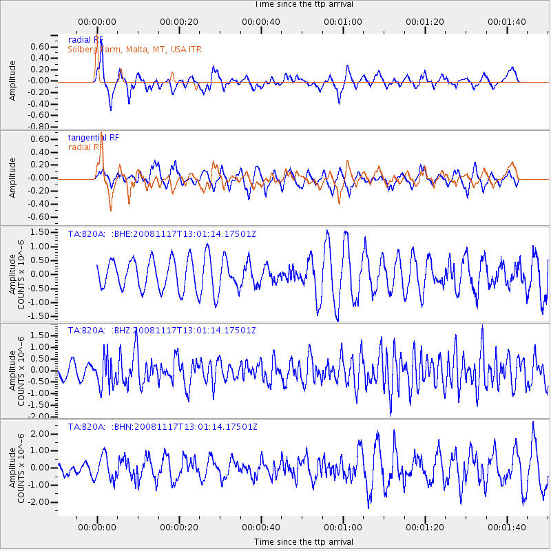
B20A Solberg Farm, Malta, MT, USA - Earthquake Result Viewer
*The percent match for this event was below the threshold and hence no stack was calculated.
| Earthquake location: |
Arctic Ocean |
| Earthquake latitude/longitude: |
79.6/-116.1 |
| Earthquake time(UTC): |
2008/11/17 (322) 12:55:22 GMT |
| Earthquake Depth: |
7.0 km |
| Earthquake Magnitude: |
5.7 MW, 5.2 MS, 5.4 MB, 5.7 MW |
| Earthquake Catalog/Contributor: |
WHDF/NEIC |
|
| Network: |
TA USArray Transportable Network (new EarthScope stations) |
| Station: |
B20A Solberg Farm, Malta, MT, USA |
| Lat/Lon: |
48.44 N/108.02 W |
| Elevation: |
827 m |
|
| Distance: |
31.5 deg |
| Az: |
169.727 deg |
| Baz: |
357.224 deg |
| Ray Param: |
$rayparam |
*The percent match for this event was below the threshold and hence was not used in the summary stack. |
|
| Radial Match: |
59.547203 % |
| Radial Bump: |
400 |
| Transverse Match: |
65.47668 % |
| Transverse Bump: |
400 |
| SOD ConfigId: |
2658 |
| Insert Time: |
2010-03-06 11:40:14.462 +0000 |
| GWidth: |
2.5 |
| Max Bumps: |
400 |
| Tol: |
0.001 |
|
Signal To Noise
| Channel | StoN | STA | LTA |
| TA:B20A: :BHZ:20081117T13:01:14.17501Z | 2.6820266 | 5.9826806E-7 | 2.2306568E-7 |
| TA:B20A: :BHN:20081117T13:01:14.17501Z | 2.06742 | 6.9668346E-7 | 3.3698208E-7 |
| TA:B20A: :BHE:20081117T13:01:14.17501Z | 1.0738846 | 5.5598457E-7 | 5.177322E-7 |
| Arrivals |
| Ps | |
| PpPs | |
| PsPs/PpSs | |


