You are here: Home > Network List > GS - US Geological Survey Networks Stations List
> Station KAN10 Keim Farm > Earthquake Result Viewer
KAN10 Keim Farm - Earthquake Result Viewer
*The percent match for this event was below the threshold and hence no stack was calculated.
| Earthquake location: |
Fiji Islands Region |
| Earthquake latitude/longitude: |
-20.8/-178.7 |
| Earthquake time(UTC): |
2016/05/27 (148) 04:08:44 GMT |
| Earthquake Depth: |
572 km |
| Earthquake Magnitude: |
6.4 MO |
| Earthquake Catalog/Contributor: |
NEIC PDE/NEIC ALERT |
|
| Network: |
GS US Geological Survey Networks |
| Station: |
KAN10 Keim Farm |
| Lat/Lon: |
37.12 N/98.10 W |
| Elevation: |
417 m |
|
| Distance: |
95.2 deg |
| Az: |
52.345 deg |
| Baz: |
247.909 deg |
| Ray Param: |
$rayparam |
*The percent match for this event was below the threshold and hence was not used in the summary stack. |
|
| Radial Match: |
74.89787 % |
| Radial Bump: |
400 |
| Transverse Match: |
79.389496 % |
| Transverse Bump: |
400 |
| SOD ConfigId: |
1475611 |
| Insert Time: |
2016-06-10 04:10:36.317 +0000 |
| GWidth: |
2.5 |
| Max Bumps: |
400 |
| Tol: |
0.001 |
|
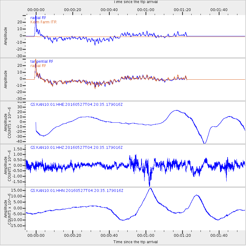
Signal To Noise
| Channel | StoN | STA | LTA |
| GS:KAN10:01:HHZ:20160527T04:20:35.179016Z | 0.94587463 | 2.3575838E-7 | 2.4924907E-7 |
| GS:KAN10:01:HHN:20160527T04:20:35.179016Z | 1.9782647 | 6.9624098E-6 | 3.519453E-6 |
| GS:KAN10:01:HHE:20160527T04:20:35.179016Z | 1.4792364 | 1.7941062E-5 | 1.21285975E-5 |
| Arrivals |
| Ps | |
| PpPs | |
| PsPs/PpSs | |


