You are here: Home > Network List > TA - USArray Transportable Network (new EarthScope stations) Stations List
> Station B20A Solberg Farm, Malta, MT, USA > Earthquake Result Viewer
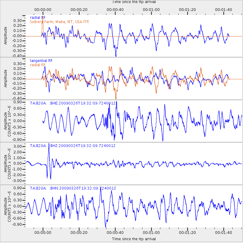
B20A Solberg Farm, Malta, MT, USA - Earthquake Result Viewer
*The percent match for this event was below the threshold and hence no stack was calculated.
| Earthquake location: |
Northwest Of Ryukyu Islands |
| Earthquake latitude/longitude: |
27.4/126.7 |
| Earthquake time(UTC): |
2009/03/26 (085) 19:19:59 GMT |
| Earthquake Depth: |
160 km |
| Earthquake Magnitude: |
5.6 MB, 5.9 MW, 5.9 MW |
| Earthquake Catalog/Contributor: |
WHDF/NEIC |
|
| Network: |
TA USArray Transportable Network (new EarthScope stations) |
| Station: |
B20A Solberg Farm, Malta, MT, USA |
| Lat/Lon: |
48.44 N/108.02 W |
| Elevation: |
827 m |
|
| Distance: |
90.0 deg |
| Az: |
32.931 deg |
| Baz: |
313.472 deg |
| Ray Param: |
$rayparam |
*The percent match for this event was below the threshold and hence was not used in the summary stack. |
|
| Radial Match: |
62.764687 % |
| Radial Bump: |
400 |
| Transverse Match: |
65.33699 % |
| Transverse Bump: |
339 |
| SOD ConfigId: |
2658 |
| Insert Time: |
2010-03-06 11:41:50.215 +0000 |
| GWidth: |
2.5 |
| Max Bumps: |
400 |
| Tol: |
0.001 |
|
Signal To Noise
| Channel | StoN | STA | LTA |
| TA:B20A: :BHZ:20090326T19:32:09.724001Z | 5.5022616 | 1.3135677E-6 | 2.3873233E-7 |
| TA:B20A: :BHN:20090326T19:32:09.724001Z | 0.84761715 | 2.3083462E-7 | 2.723336E-7 |
| TA:B20A: :BHE:20090326T19:32:09.724001Z | 0.7420209 | 2.2199504E-7 | 2.9917626E-7 |
| Arrivals |
| Ps | |
| PpPs | |
| PsPs/PpSs | |


