You are here: Home > Network List > TA - USArray Transportable Network (new EarthScope stations) Stations List
> Station 121A Cookes Peak, Deming, NM, USA > Earthquake Result Viewer
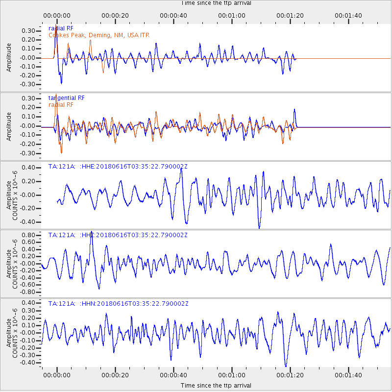
121A Cookes Peak, Deming, NM, USA - Earthquake Result Viewer
*The percent match for this event was below the threshold and hence no stack was calculated.
| Earthquake location: |
Fiji Islands Region |
| Earthquake latitude/longitude: |
-16.2/-177.6 |
| Earthquake time(UTC): |
2018/06/16 (167) 03:23:32 GMT |
| Earthquake Depth: |
10 km |
| Earthquake Magnitude: |
5.5 mb |
| Earthquake Catalog/Contributor: |
NEIC PDE/us |
|
| Network: |
TA USArray Transportable Network (new EarthScope stations) |
| Station: |
121A Cookes Peak, Deming, NM, USA |
| Lat/Lon: |
32.53 N/107.79 W |
| Elevation: |
1652 m |
|
| Distance: |
82.5 deg |
| Az: |
53.109 deg |
| Baz: |
245.43 deg |
| Ray Param: |
$rayparam |
*The percent match for this event was below the threshold and hence was not used in the summary stack. |
|
| Radial Match: |
76.039925 % |
| Radial Bump: |
400 |
| Transverse Match: |
51.331543 % |
| Transverse Bump: |
400 |
| SOD ConfigId: |
13570011 |
| Insert Time: |
2019-04-30 09:29:58.465 +0000 |
| GWidth: |
2.5 |
| Max Bumps: |
400 |
| Tol: |
0.001 |
|
Signal To Noise
| Channel | StoN | STA | LTA |
| TA:121A: :HHZ:20180616T03:35:22.790002Z | 2.8533201 | 2.7381242E-7 | 9.596275E-8 |
| TA:121A: :HHN:20180616T03:35:22.790002Z | 0.94577765 | 8.957865E-8 | 9.471428E-8 |
| TA:121A: :HHE:20180616T03:35:22.790002Z | 0.59423876 | 5.7565035E-8 | 9.6871894E-8 |
| Arrivals |
| Ps | |
| PpPs | |
| PsPs/PpSs | |


