You are here: Home > Network List > UW - Pacific Northwest Regional Seismic Network Stations List
> Station UMAT Pilot Rock, OR, USA > Earthquake Result Viewer
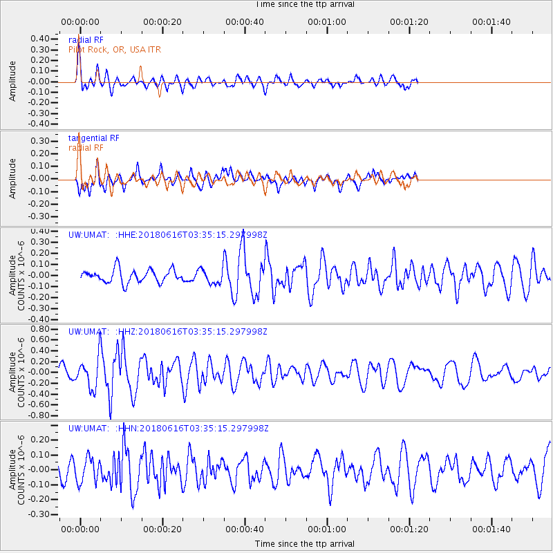
UMAT Pilot Rock, OR, USA - Earthquake Result Viewer
*The percent match for this event was below the threshold and hence no stack was calculated.
| Earthquake location: |
Fiji Islands Region |
| Earthquake latitude/longitude: |
-16.2/-177.6 |
| Earthquake time(UTC): |
2018/06/16 (167) 03:23:32 GMT |
| Earthquake Depth: |
10 km |
| Earthquake Magnitude: |
5.5 mb |
| Earthquake Catalog/Contributor: |
NEIC PDE/us |
|
| Network: |
UW Pacific Northwest Regional Seismic Network |
| Station: |
UMAT Pilot Rock, OR, USA |
| Lat/Lon: |
45.29 N/118.96 W |
| Elevation: |
1318 m |
|
| Distance: |
81.0 deg |
| Az: |
37.61 deg |
| Baz: |
236.145 deg |
| Ray Param: |
$rayparam |
*The percent match for this event was below the threshold and hence was not used in the summary stack. |
|
| Radial Match: |
75.07843 % |
| Radial Bump: |
400 |
| Transverse Match: |
63.23657 % |
| Transverse Bump: |
400 |
| SOD ConfigId: |
13570011 |
| Insert Time: |
2019-04-30 09:31:56.004 +0000 |
| GWidth: |
2.5 |
| Max Bumps: |
400 |
| Tol: |
0.001 |
|
Signal To Noise
| Channel | StoN | STA | LTA |
| UW:UMAT: :HHZ:20180616T03:35:15.297998Z | 2.9431837 | 2.9981388E-7 | 1.018672E-7 |
| UW:UMAT: :HHN:20180616T03:35:15.297998Z | 1.4526103 | 8.469409E-8 | 5.8304764E-8 |
| UW:UMAT: :HHE:20180616T03:35:15.297998Z | 1.528392 | 9.020818E-8 | 5.902163E-8 |
| Arrivals |
| Ps | |
| PpPs | |
| PsPs/PpSs | |


