You are here: Home > Network List > US - United States National Seismic Network Stations List
> Station WUAZ Wupatki, Arizona, USA > Earthquake Result Viewer
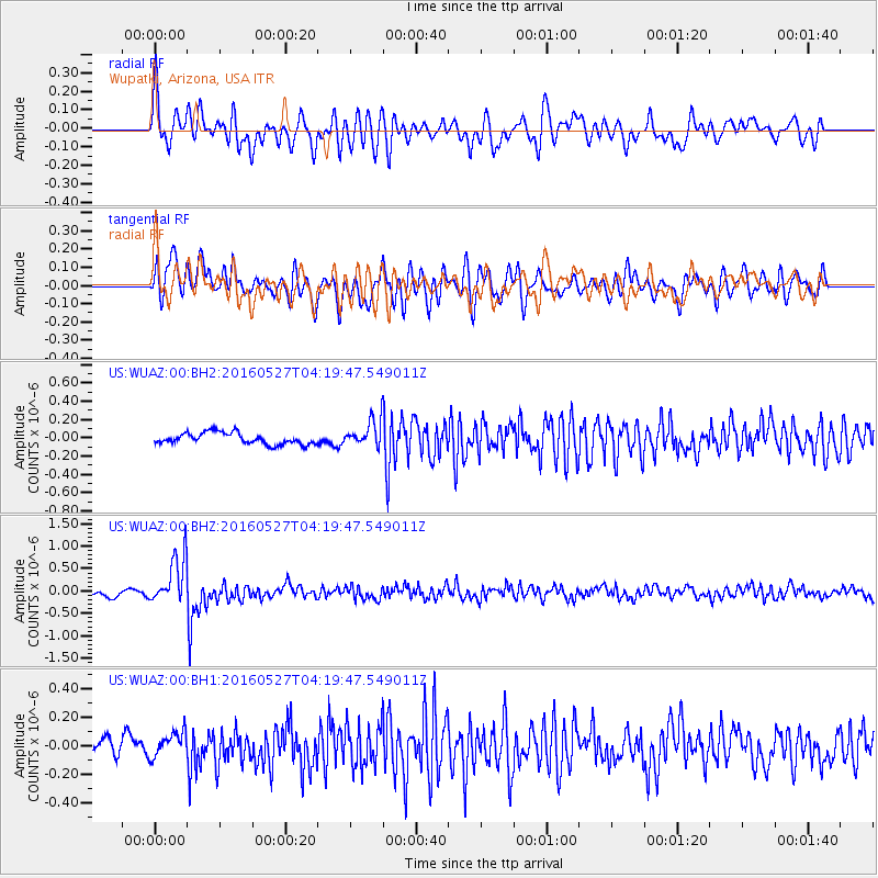
WUAZ Wupatki, Arizona, USA - Earthquake Result Viewer
*The percent match for this event was below the threshold and hence no stack was calculated.
| Earthquake location: |
Fiji Islands Region |
| Earthquake latitude/longitude: |
-20.8/-178.7 |
| Earthquake time(UTC): |
2016/05/27 (148) 04:08:44 GMT |
| Earthquake Depth: |
572 km |
| Earthquake Magnitude: |
6.4 MO |
| Earthquake Catalog/Contributor: |
NEIC PDE/NEIC ALERT |
|
| Network: |
US United States National Seismic Network |
| Station: |
WUAZ Wupatki, Arizona, USA |
| Lat/Lon: |
35.52 N/111.37 W |
| Elevation: |
1592 m |
|
| Distance: |
84.8 deg |
| Az: |
49.082 deg |
| Baz: |
240.054 deg |
| Ray Param: |
$rayparam |
*The percent match for this event was below the threshold and hence was not used in the summary stack. |
|
| Radial Match: |
76.0755 % |
| Radial Bump: |
400 |
| Transverse Match: |
65.81993 % |
| Transverse Bump: |
400 |
| SOD ConfigId: |
1475611 |
| Insert Time: |
2016-06-10 04:15:47.030 +0000 |
| GWidth: |
2.5 |
| Max Bumps: |
400 |
| Tol: |
0.001 |
|
Signal To Noise
| Channel | StoN | STA | LTA |
| US:WUAZ:00:BHZ:20160527T04:19:47.549011Z | 7.0384808 | 5.403414E-7 | 7.67696E-8 |
| US:WUAZ:00:BH1:20160527T04:19:47.549011Z | 1.2287953 | 9.502119E-8 | 7.732874E-8 |
| US:WUAZ:00:BH2:20160527T04:19:47.549011Z | 2.2691572 | 1.4189017E-7 | 6.25299E-8 |
| Arrivals |
| Ps | |
| PpPs | |
| PsPs/PpSs | |


