You are here: Home > Network List > TA - USArray Transportable Network (new EarthScope stations) Stations List
> Station BGNE Belgrade, NE, USA > Earthquake Result Viewer
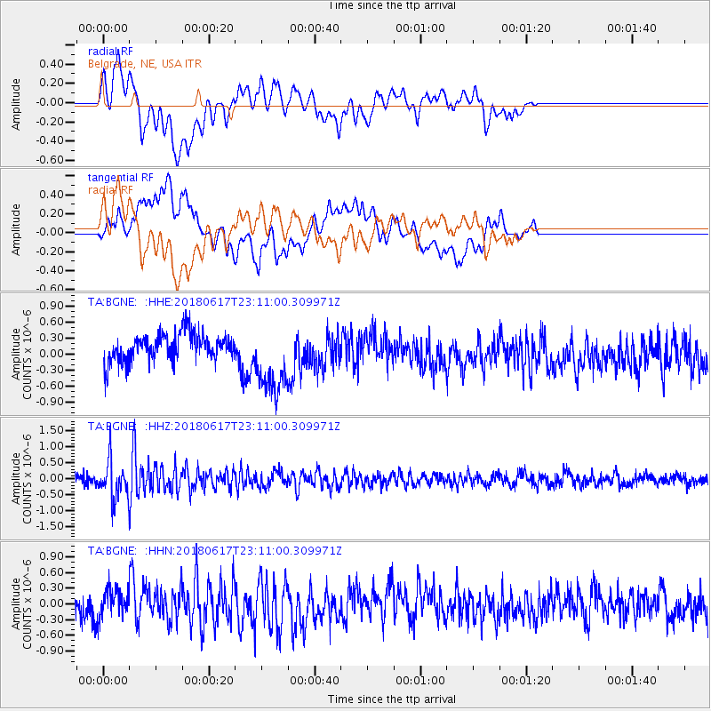
BGNE Belgrade, NE, USA - Earthquake Result Viewer
*The percent match for this event was below the threshold and hence no stack was calculated.
| Earthquake location: |
Near S. Coast Of Western Honshu |
| Earthquake latitude/longitude: |
34.8/135.6 |
| Earthquake time(UTC): |
2018/06/17 (168) 22:58:35 GMT |
| Earthquake Depth: |
11 km |
| Earthquake Magnitude: |
5.5 Mww |
| Earthquake Catalog/Contributor: |
NEIC PDE/us |
|
| Network: |
TA USArray Transportable Network (new EarthScope stations) |
| Station: |
BGNE Belgrade, NE, USA |
| Lat/Lon: |
41.41 N/98.15 W |
| Elevation: |
573 m |
|
| Distance: |
89.5 deg |
| Az: |
37.354 deg |
| Baz: |
318.431 deg |
| Ray Param: |
$rayparam |
*The percent match for this event was below the threshold and hence was not used in the summary stack. |
|
| Radial Match: |
58.827496 % |
| Radial Bump: |
400 |
| Transverse Match: |
57.302383 % |
| Transverse Bump: |
400 |
| SOD ConfigId: |
13570011 |
| Insert Time: |
2019-04-30 09:40:44.004 +0000 |
| GWidth: |
2.5 |
| Max Bumps: |
400 |
| Tol: |
0.001 |
|
Signal To Noise
| Channel | StoN | STA | LTA |
| TA:BGNE: :HHZ:20180617T23:11:00.309971Z | 3.9229918 | 6.2683466E-7 | 1.5978486E-7 |
| TA:BGNE: :HHN:20180617T23:11:00.309971Z | 1.2440153 | 2.6411595E-7 | 2.1230926E-7 |
| TA:BGNE: :HHE:20180617T23:11:00.309971Z | 2.7666714 | 6.999747E-7 | 2.5300247E-7 |
| Arrivals |
| Ps | |
| PpPs | |
| PsPs/PpSs | |


