You are here: Home > Network List > TA - USArray Transportable Network (new EarthScope stations) Stations List
> Station G31M Satah River, YT, CAN > Earthquake Result Viewer
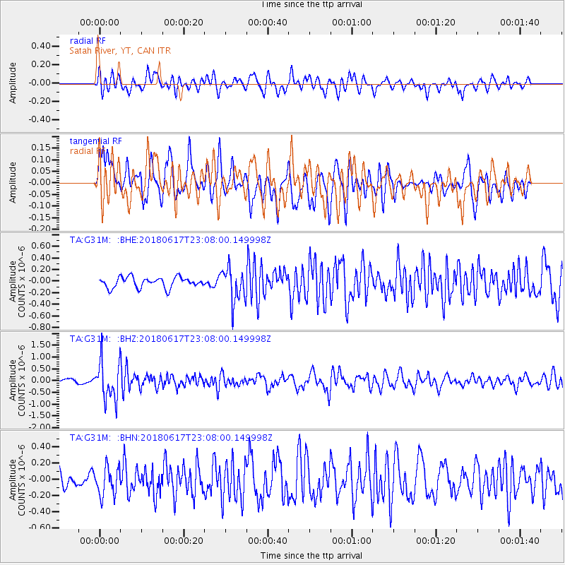
G31M Satah River, YT, CAN - Earthquake Result Viewer
*The percent match for this event was below the threshold and hence no stack was calculated.
| Earthquake location: |
Near S. Coast Of Western Honshu |
| Earthquake latitude/longitude: |
34.8/135.6 |
| Earthquake time(UTC): |
2018/06/17 (168) 22:58:35 GMT |
| Earthquake Depth: |
11 km |
| Earthquake Magnitude: |
5.5 Mww |
| Earthquake Catalog/Contributor: |
NEIC PDE/us |
|
| Network: |
TA USArray Transportable Network (new EarthScope stations) |
| Station: |
G31M Satah River, YT, CAN |
| Lat/Lon: |
66.92 N/134.27 W |
| Elevation: |
61 m |
|
| Distance: |
58.5 deg |
| Az: |
27.525 deg |
| Baz: |
285.342 deg |
| Ray Param: |
$rayparam |
*The percent match for this event was below the threshold and hence was not used in the summary stack. |
|
| Radial Match: |
57.96971 % |
| Radial Bump: |
400 |
| Transverse Match: |
54.777878 % |
| Transverse Bump: |
400 |
| SOD ConfigId: |
13570011 |
| Insert Time: |
2019-04-30 09:41:22.928 +0000 |
| GWidth: |
2.5 |
| Max Bumps: |
400 |
| Tol: |
0.001 |
|
Signal To Noise
| Channel | StoN | STA | LTA |
| TA:G31M: :BHZ:20180617T23:08:00.149998Z | 6.933851 | 8.331493E-7 | 1.201568E-7 |
| TA:G31M: :BHN:20180617T23:08:00.149998Z | 1.2187563 | 1.7702972E-7 | 1.4525439E-7 |
| TA:G31M: :BHE:20180617T23:08:00.149998Z | 3.2305977 | 2.9243904E-7 | 9.0521645E-8 |
| Arrivals |
| Ps | |
| PpPs | |
| PsPs/PpSs | |


