You are here: Home > Network List > UW - Pacific Northwest Regional Seismic Network Stations List
> Station LEBA Lebam, WA, USA > Earthquake Result Viewer
LEBA Lebam, WA, USA - Earthquake Result Viewer
*The percent match for this event was below the threshold and hence no stack was calculated.
| Earthquake location: |
Near S. Coast Of Western Honshu |
| Earthquake latitude/longitude: |
34.8/135.6 |
| Earthquake time(UTC): |
2018/06/17 (168) 22:58:35 GMT |
| Earthquake Depth: |
11 km |
| Earthquake Magnitude: |
5.5 Mww |
| Earthquake Catalog/Contributor: |
NEIC PDE/us |
|
| Network: |
UW Pacific Northwest Regional Seismic Network |
| Station: |
LEBA Lebam, WA, USA |
| Lat/Lon: |
46.55 N/123.56 W |
| Elevation: |
73 m |
|
| Distance: |
72.3 deg |
| Az: |
45.381 deg |
| Baz: |
301.967 deg |
| Ray Param: |
$rayparam |
*The percent match for this event was below the threshold and hence was not used in the summary stack. |
|
| Radial Match: |
63.323242 % |
| Radial Bump: |
400 |
| Transverse Match: |
53.409138 % |
| Transverse Bump: |
400 |
| SOD ConfigId: |
13570011 |
| Insert Time: |
2019-04-30 09:43:24.004 +0000 |
| GWidth: |
2.5 |
| Max Bumps: |
400 |
| Tol: |
0.001 |
|
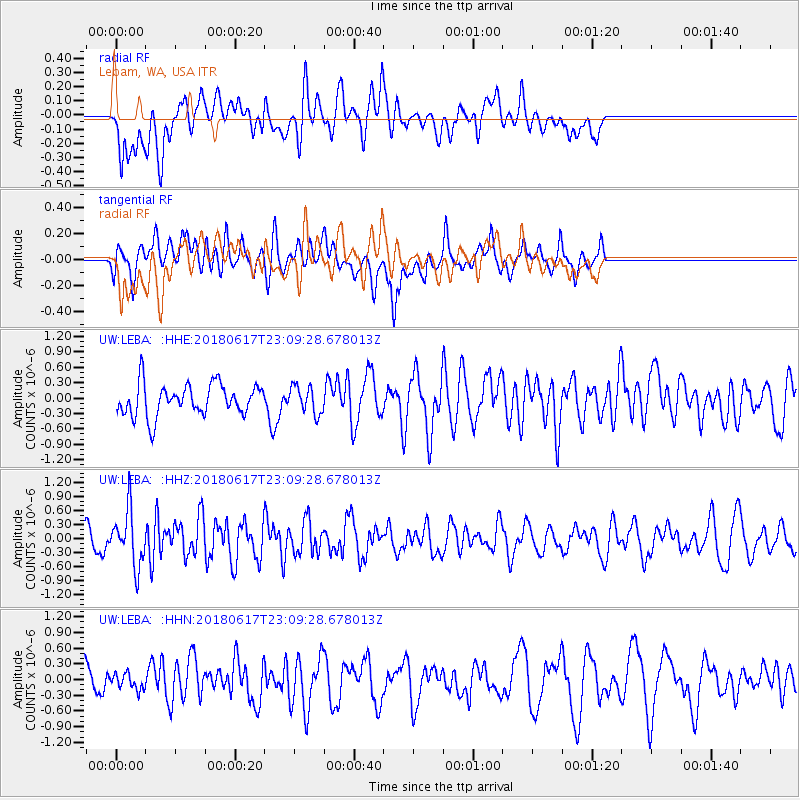
Signal To Noise
| Channel | StoN | STA | LTA |
| UW:LEBA: :HHZ:20180617T23:09:28.678013Z | 2.4713726 | 5.8845694E-7 | 2.3810937E-7 |
| UW:LEBA: :HHN:20180617T23:09:28.678013Z | 0.47545063 | 1.4724732E-7 | 3.0970054E-7 |
| UW:LEBA: :HHE:20180617T23:09:28.678013Z | 0.87174827 | 2.6741665E-7 | 3.06759E-7 |
| Arrivals |
| Ps | |
| PpPs | |
| PsPs/PpSs | |


