You are here: Home > Network List > CI - Caltech Regional Seismic Network Stations List
> Station SMM Simmler, CA, USA > Earthquake Result Viewer
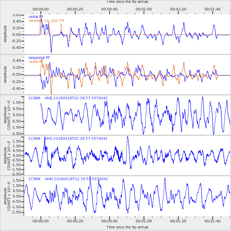
SMM Simmler, CA, USA - Earthquake Result Viewer
*The percent match for this event was below the threshold and hence no stack was calculated.
| Earthquake location: |
Guatemala |
| Earthquake latitude/longitude: |
14.1/-90.7 |
| Earthquake time(UTC): |
2018/06/18 (169) 02:32:55 GMT |
| Earthquake Depth: |
98 km |
| Earthquake Magnitude: |
5.7 Mww |
| Earthquake Catalog/Contributor: |
NEIC PDE/us |
|
| Network: |
CI Caltech Regional Seismic Network |
| Station: |
SMM Simmler, CA, USA |
| Lat/Lon: |
35.31 N/120.00 W |
| Elevation: |
599 m |
|
| Distance: |
33.7 deg |
| Az: |
313.921 deg |
| Baz: |
121.302 deg |
| Ray Param: |
$rayparam |
*The percent match for this event was below the threshold and hence was not used in the summary stack. |
|
| Radial Match: |
60.63616 % |
| Radial Bump: |
400 |
| Transverse Match: |
68.254456 % |
| Transverse Bump: |
400 |
| SOD ConfigId: |
13570011 |
| Insert Time: |
2019-04-30 09:46:43.043 +0000 |
| GWidth: |
2.5 |
| Max Bumps: |
400 |
| Tol: |
0.001 |
|
Signal To Noise
| Channel | StoN | STA | LTA |
| CI:SMM: :HHZ:20180618T02:38:57.567994Z | 3.3031943 | 9.251685E-7 | 2.80083E-7 |
| CI:SMM: :HHN:20180618T02:38:57.567994Z | 0.7062205 | 3.31598E-7 | 4.6953892E-7 |
| CI:SMM: :HHE:20180618T02:38:57.567994Z | 1.1916788 | 5.6251343E-7 | 4.7203443E-7 |
| Arrivals |
| Ps | |
| PpPs | |
| PsPs/PpSs | |


