You are here: Home > Network List > TA - USArray Transportable Network (new EarthScope stations) Stations List
> Station G31M Satah River, YT, CAN > Earthquake Result Viewer
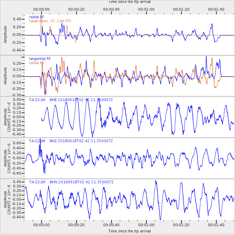
G31M Satah River, YT, CAN - Earthquake Result Viewer
*The percent match for this event was below the threshold and hence no stack was calculated.
| Earthquake location: |
Guatemala |
| Earthquake latitude/longitude: |
14.1/-90.7 |
| Earthquake time(UTC): |
2018/06/18 (169) 02:32:55 GMT |
| Earthquake Depth: |
98 km |
| Earthquake Magnitude: |
5.7 Mww |
| Earthquake Catalog/Contributor: |
NEIC PDE/us |
|
| Network: |
TA USArray Transportable Network (new EarthScope stations) |
| Station: |
G31M Satah River, YT, CAN |
| Lat/Lon: |
66.92 N/134.27 W |
| Elevation: |
61 m |
|
| Distance: |
60.0 deg |
| Az: |
341.718 deg |
| Baz: |
129.468 deg |
| Ray Param: |
$rayparam |
*The percent match for this event was below the threshold and hence was not used in the summary stack. |
|
| Radial Match: |
56.57237 % |
| Radial Bump: |
400 |
| Transverse Match: |
55.69965 % |
| Transverse Bump: |
378 |
| SOD ConfigId: |
13570011 |
| Insert Time: |
2019-04-30 09:50:04.083 +0000 |
| GWidth: |
2.5 |
| Max Bumps: |
400 |
| Tol: |
0.001 |
|
Signal To Noise
| Channel | StoN | STA | LTA |
| TA:G31M: :BHZ:20180618T02:42:21.350007Z | 1.9902984 | 2.683855E-7 | 1.3484686E-7 |
| TA:G31M: :BHN:20180618T02:42:21.350007Z | 1.5406773 | 1.7504972E-7 | 1.13618675E-7 |
| TA:G31M: :BHE:20180618T02:42:21.350007Z | 1.2942812 | 2.8971812E-7 | 2.238448E-7 |
| Arrivals |
| Ps | |
| PpPs | |
| PsPs/PpSs | |


