You are here: Home > Network List > CI - Caltech Regional Seismic Network Stations List
> Station MPM Manuel Prospect Mine, California, USA > Earthquake Result Viewer
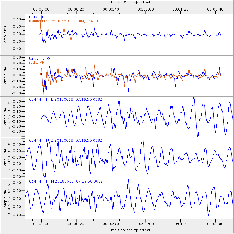
MPM Manuel Prospect Mine, California, USA - Earthquake Result Viewer
*The percent match for this event was below the threshold and hence no stack was calculated.
| Earthquake location: |
Easter Island Region |
| Earthquake latitude/longitude: |
-29.9/-111.9 |
| Earthquake time(UTC): |
2018/06/18 (169) 07:09:41 GMT |
| Earthquake Depth: |
10 km |
| Earthquake Magnitude: |
5.9 Mww |
| Earthquake Catalog/Contributor: |
NEIC PDE/us |
|
| Network: |
CI Caltech Regional Seismic Network |
| Station: |
MPM Manuel Prospect Mine, California, USA |
| Lat/Lon: |
36.06 N/117.49 W |
| Elevation: |
185 m |
|
| Distance: |
65.9 deg |
| Az: |
355.018 deg |
| Baz: |
174.662 deg |
| Ray Param: |
$rayparam |
*The percent match for this event was below the threshold and hence was not used in the summary stack. |
|
| Radial Match: |
63.53615 % |
| Radial Bump: |
400 |
| Transverse Match: |
78.62119 % |
| Transverse Bump: |
400 |
| SOD ConfigId: |
13570011 |
| Insert Time: |
2019-04-30 09:53:50.977 +0000 |
| GWidth: |
2.5 |
| Max Bumps: |
400 |
| Tol: |
0.001 |
|
Signal To Noise
| Channel | StoN | STA | LTA |
| CI:MPM: :HHZ:20180618T07:19:56.068Z | 2.36034 | 4.2296375E-7 | 1.791961E-7 |
| CI:MPM: :HHN:20180618T07:19:56.068Z | 1.9494456 | 2.1753243E-7 | 1.11586814E-7 |
| CI:MPM: :HHE:20180618T07:19:56.068Z | 1.1254991 | 1.1168926E-7 | 9.9235315E-8 |
| Arrivals |
| Ps | |
| PpPs | |
| PsPs/PpSs | |


