You are here: Home > Network List > CI - Caltech Regional Seismic Network Stations List
> Station GLA Glamis, Glamis, CA, USA > Earthquake Result Viewer
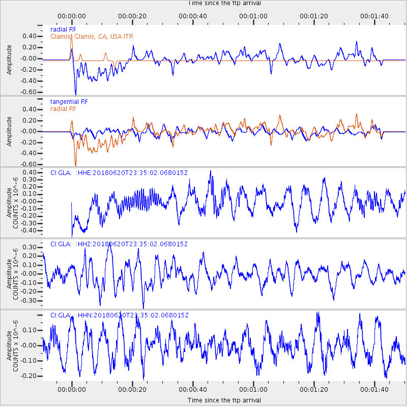
GLA Glamis, Glamis, CA, USA - Earthquake Result Viewer
*The percent match for this event was below the threshold and hence no stack was calculated.
| Earthquake location: |
Tonga Islands Region |
| Earthquake latitude/longitude: |
-22.4/-175.1 |
| Earthquake time(UTC): |
2018/06/20 (171) 23:23:26 GMT |
| Earthquake Depth: |
14 km |
| Earthquake Magnitude: |
5.4 Mww |
| Earthquake Catalog/Contributor: |
NEIC PDE/us |
|
| Network: |
CI Caltech Regional Seismic Network |
| Station: |
GLA Glamis, Glamis, CA, USA |
| Lat/Lon: |
33.05 N/114.83 W |
| Elevation: |
610 m |
|
| Distance: |
79.6 deg |
| Az: |
47.842 deg |
| Baz: |
234.783 deg |
| Ray Param: |
$rayparam |
*The percent match for this event was below the threshold and hence was not used in the summary stack. |
|
| Radial Match: |
53.163277 % |
| Radial Bump: |
400 |
| Transverse Match: |
49.97924 % |
| Transverse Bump: |
400 |
| SOD ConfigId: |
13570011 |
| Insert Time: |
2019-04-30 10:02:43.757 +0000 |
| GWidth: |
2.5 |
| Max Bumps: |
400 |
| Tol: |
0.001 |
|
Signal To Noise
| Channel | StoN | STA | LTA |
| CI:GLA: :HHZ:20180620T23:35:02.068015Z | 0.8993826 | 1.19042724E-7 | 1.323605E-7 |
| CI:GLA: :HHN:20180620T23:35:02.068015Z | 1.3877113 | 1.6439402E-7 | 1.18464136E-7 |
| CI:GLA: :HHE:20180620T23:35:02.068015Z | 0.9787302 | 1.5269511E-7 | 1.5601348E-7 |
| Arrivals |
| Ps | |
| PpPs | |
| PsPs/PpSs | |


