You are here: Home > Network List > TA - USArray Transportable Network (new EarthScope stations) Stations List
> Station P17K Kvichak River, AK, USA > Earthquake Result Viewer
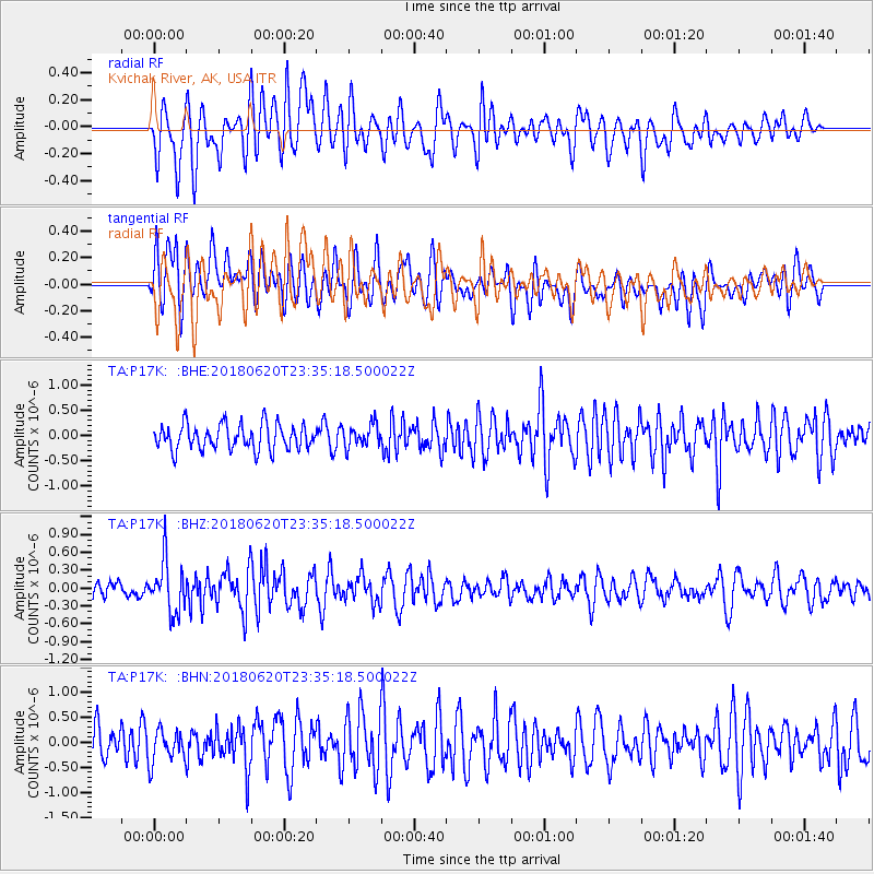
P17K Kvichak River, AK, USA - Earthquake Result Viewer
*The percent match for this event was below the threshold and hence no stack was calculated.
| Earthquake location: |
Tonga Islands Region |
| Earthquake latitude/longitude: |
-22.4/-175.1 |
| Earthquake time(UTC): |
2018/06/20 (171) 23:23:26 GMT |
| Earthquake Depth: |
14 km |
| Earthquake Magnitude: |
5.4 Mww |
| Earthquake Catalog/Contributor: |
NEIC PDE/us |
|
| Network: |
TA USArray Transportable Network (new EarthScope stations) |
| Station: |
P17K Kvichak River, AK, USA |
| Lat/Lon: |
59.20 N/156.44 W |
| Elevation: |
91 m |
|
| Distance: |
82.7 deg |
| Az: |
9.544 deg |
| Baz: |
197.35 deg |
| Ray Param: |
$rayparam |
*The percent match for this event was below the threshold and hence was not used in the summary stack. |
|
| Radial Match: |
54.27497 % |
| Radial Bump: |
400 |
| Transverse Match: |
64.85065 % |
| Transverse Bump: |
400 |
| SOD ConfigId: |
13570011 |
| Insert Time: |
2019-04-30 10:06:44.791 +0000 |
| GWidth: |
2.5 |
| Max Bumps: |
400 |
| Tol: |
0.001 |
|
Signal To Noise
| Channel | StoN | STA | LTA |
| TA:P17K: :BHZ:20180620T23:35:18.500022Z | 2.9557736 | 4.2952215E-7 | 1.4531632E-7 |
| TA:P17K: :BHN:20180620T23:35:18.500022Z | 0.8853586 | 3.2987091E-7 | 3.7258454E-7 |
| TA:P17K: :BHE:20180620T23:35:18.500022Z | 0.89562577 | 2.2569779E-7 | 2.5200012E-7 |
| Arrivals |
| Ps | |
| PpPs | |
| PsPs/PpSs | |


