You are here: Home > Network List > UW - Pacific Northwest Regional Seismic Network Stations List
> Station UMAT Pilot Rock, OR, USA > Earthquake Result Viewer
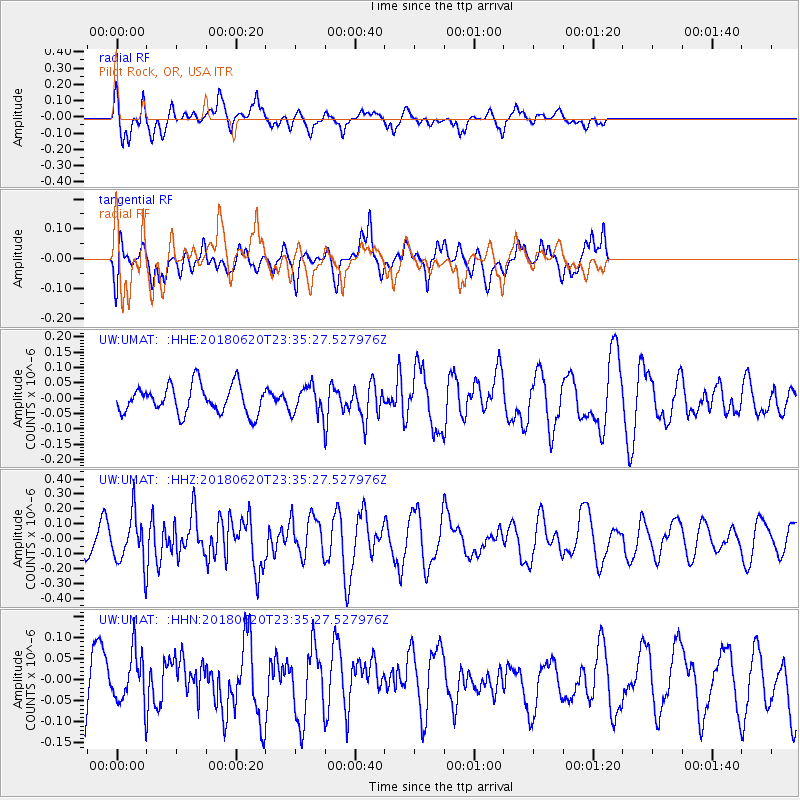
UMAT Pilot Rock, OR, USA - Earthquake Result Viewer
*The percent match for this event was below the threshold and hence no stack was calculated.
| Earthquake location: |
Tonga Islands Region |
| Earthquake latitude/longitude: |
-22.4/-175.1 |
| Earthquake time(UTC): |
2018/06/20 (171) 23:23:26 GMT |
| Earthquake Depth: |
14 km |
| Earthquake Magnitude: |
5.4 Mww |
| Earthquake Catalog/Contributor: |
NEIC PDE/us |
|
| Network: |
UW Pacific Northwest Regional Seismic Network |
| Station: |
UMAT Pilot Rock, OR, USA |
| Lat/Lon: |
45.29 N/118.96 W |
| Elevation: |
1318 m |
|
| Distance: |
84.5 deg |
| Az: |
36.068 deg |
| Baz: |
230.532 deg |
| Ray Param: |
$rayparam |
*The percent match for this event was below the threshold and hence was not used in the summary stack. |
|
| Radial Match: |
66.64791 % |
| Radial Bump: |
400 |
| Transverse Match: |
56.71117 % |
| Transverse Bump: |
379 |
| SOD ConfigId: |
13570011 |
| Insert Time: |
2019-04-30 10:07:48.117 +0000 |
| GWidth: |
2.5 |
| Max Bumps: |
400 |
| Tol: |
0.001 |
|
Signal To Noise
| Channel | StoN | STA | LTA |
| UW:UMAT: :HHZ:20180620T23:35:27.527976Z | 1.4773294 | 1.5905114E-7 | 1.0766125E-7 |
| UW:UMAT: :HHN:20180620T23:35:27.527976Z | 0.99951875 | 6.136658E-8 | 6.139612E-8 |
| UW:UMAT: :HHE:20180620T23:35:27.527976Z | 0.95559555 | 4.3726434E-8 | 4.5758306E-8 |
| Arrivals |
| Ps | |
| PpPs | |
| PsPs/PpSs | |


