You are here: Home > Network List > UW - Pacific Northwest Regional Seismic Network Stations List
> Station FISH Seaside, OR, USA > Earthquake Result Viewer
FISH Seaside, OR, USA - Earthquake Result Viewer
*The percent match for this event was below the threshold and hence no stack was calculated.
| Earthquake location: |
Chile-Argentina Border Region |
| Earthquake latitude/longitude: |
-24.3/-67.1 |
| Earthquake time(UTC): |
2018/06/21 (172) 16:08:02 GMT |
| Earthquake Depth: |
175 km |
| Earthquake Magnitude: |
5.7 Mww |
| Earthquake Catalog/Contributor: |
NEIC PDE/us |
|
| Network: |
UW Pacific Northwest Regional Seismic Network |
| Station: |
FISH Seaside, OR, USA |
| Lat/Lon: |
45.93 N/123.56 W |
| Elevation: |
325 m |
|
| Distance: |
86.7 deg |
| Az: |
324.342 deg |
| Baz: |
130.358 deg |
| Ray Param: |
$rayparam |
*The percent match for this event was below the threshold and hence was not used in the summary stack. |
|
| Radial Match: |
47.438713 % |
| Radial Bump: |
400 |
| Transverse Match: |
34.173183 % |
| Transverse Bump: |
400 |
| SOD ConfigId: |
13570011 |
| Insert Time: |
2019-04-30 10:18:36.615 +0000 |
| GWidth: |
2.5 |
| Max Bumps: |
400 |
| Tol: |
0.001 |
|
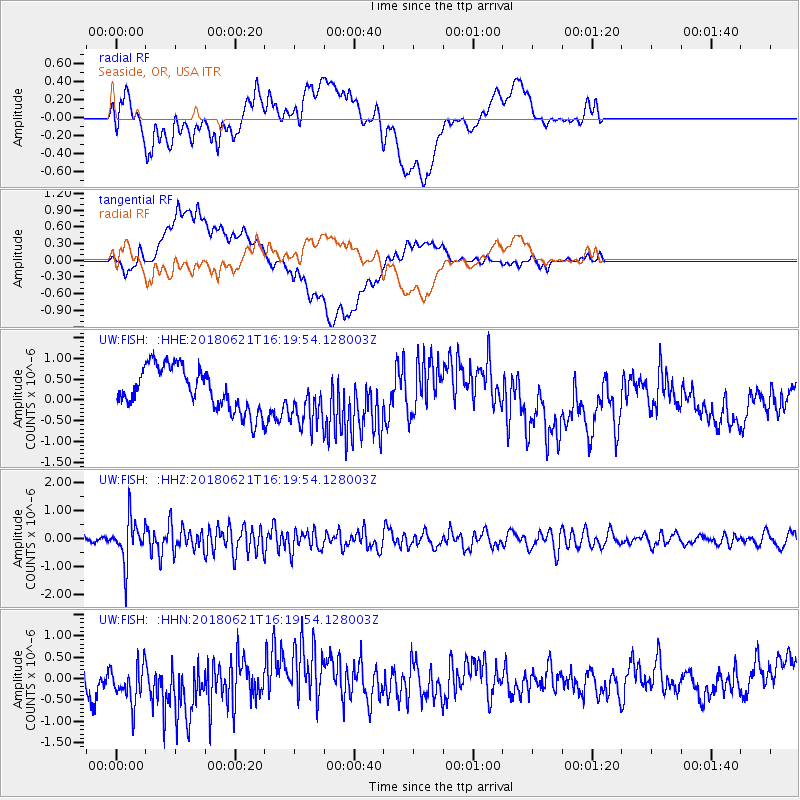
Signal To Noise
| Channel | StoN | STA | LTA |
| UW:FISH: :HHZ:20180621T16:19:54.128003Z | 5.5208645 | 7.7117915E-7 | 1.3968449E-7 |
| UW:FISH: :HHN:20180621T16:19:54.128003Z | 2.0930955 | 5.5996503E-7 | 2.675296E-7 |
| UW:FISH: :HHE:20180621T16:19:54.128003Z | 1.2944798 | 6.8668044E-7 | 5.304682E-7 |
| Arrivals |
| Ps | |
| PpPs | |
| PsPs/PpSs | |


