You are here: Home > Network List > UW - Pacific Northwest Regional Seismic Network Stations List
> Station YACT Amboy, WA, USA > Earthquake Result Viewer
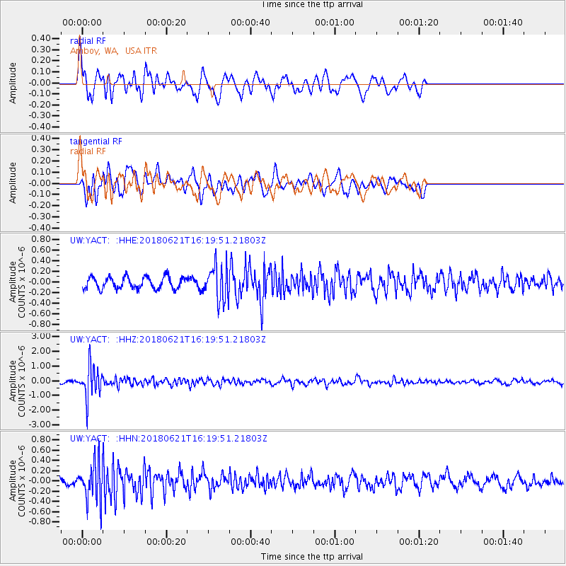
YACT Amboy, WA, USA - Earthquake Result Viewer
*The percent match for this event was below the threshold and hence no stack was calculated.
| Earthquake location: |
Chile-Argentina Border Region |
| Earthquake latitude/longitude: |
-24.3/-67.1 |
| Earthquake time(UTC): |
2018/06/21 (172) 16:08:02 GMT |
| Earthquake Depth: |
175 km |
| Earthquake Magnitude: |
5.7 Mww |
| Earthquake Catalog/Contributor: |
NEIC PDE/us |
|
| Network: |
UW Pacific Northwest Regional Seismic Network |
| Station: |
YACT Amboy, WA, USA |
| Lat/Lon: |
45.93 N/122.42 W |
| Elevation: |
211 m |
|
| Distance: |
86.1 deg |
| Az: |
324.864 deg |
| Baz: |
131.208 deg |
| Ray Param: |
$rayparam |
*The percent match for this event was below the threshold and hence was not used in the summary stack. |
|
| Radial Match: |
73.09222 % |
| Radial Bump: |
398 |
| Transverse Match: |
69.21865 % |
| Transverse Bump: |
400 |
| SOD ConfigId: |
13570011 |
| Insert Time: |
2019-04-30 10:18:59.706 +0000 |
| GWidth: |
2.5 |
| Max Bumps: |
400 |
| Tol: |
0.001 |
|
Signal To Noise
| Channel | StoN | STA | LTA |
| UW:YACT: :HHZ:20180621T16:19:51.21803Z | 12.113975 | 1.0830504E-6 | 8.940504E-8 |
| UW:YACT: :HHN:20180621T16:19:51.21803Z | 3.7789507 | 3.8800158E-7 | 1.0267443E-7 |
| UW:YACT: :HHE:20180621T16:19:51.21803Z | 3.2084382 | 3.5460775E-7 | 1.1052348E-7 |
| Arrivals |
| Ps | |
| PpPs | |
| PsPs/PpSs | |


