You are here: Home > Network List > AV - Alaska Volcano Observatory Stations List
> Station SPCR Ckakachatna River, Mount Spurr, Alaska > Earthquake Result Viewer
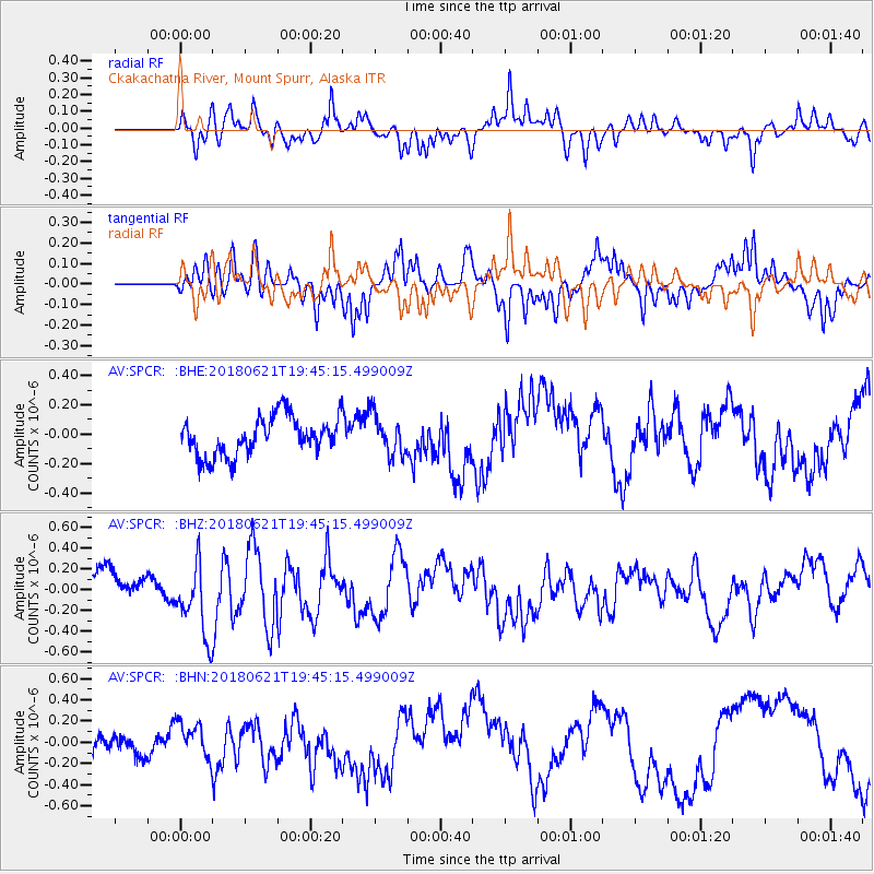
SPCR Ckakachatna River, Mount Spurr, Alaska - Earthquake Result Viewer
*The percent match for this event was below the threshold and hence no stack was calculated.
| Earthquake location: |
Tonga Islands Region |
| Earthquake latitude/longitude: |
-22.5/-174.9 |
| Earthquake time(UTC): |
2018/06/21 (172) 19:33:08 GMT |
| Earthquake Depth: |
4.8 km |
| Earthquake Magnitude: |
5.4 mb |
| Earthquake Catalog/Contributor: |
NEIC PDE/us |
|
| Network: |
AV Alaska Volcano Observatory |
| Station: |
SPCR Ckakachatna River, Mount Spurr, Alaska |
| Lat/Lon: |
61.20 N/152.21 W |
| Elevation: |
984 m |
|
| Distance: |
85.4 deg |
| Az: |
10.806 deg |
| Baz: |
200.975 deg |
| Ray Param: |
$rayparam |
*The percent match for this event was below the threshold and hence was not used in the summary stack. |
|
| Radial Match: |
62.24523 % |
| Radial Bump: |
400 |
| Transverse Match: |
76.612564 % |
| Transverse Bump: |
400 |
| SOD ConfigId: |
13570011 |
| Insert Time: |
2019-04-30 10:21:42.386 +0000 |
| GWidth: |
2.5 |
| Max Bumps: |
400 |
| Tol: |
0.001 |
|
Signal To Noise
| Channel | StoN | STA | LTA |
| AV:SPCR: :BHZ:20180621T19:45:15.499009Z | 3.4222283 | 3.7545962E-7 | 1.09712026E-7 |
| AV:SPCR: :BHN:20180621T19:45:15.499009Z | 1.3693266 | 1.634893E-7 | 1.1939395E-7 |
| AV:SPCR: :BHE:20180621T19:45:15.499009Z | 1.0332508 | 1.3646967E-7 | 1.3207797E-7 |
| Arrivals |
| Ps | |
| PpPs | |
| PsPs/PpSs | |


