You are here: Home > Network List > TA - USArray Transportable Network (new EarthScope stations) Stations List
> Station D17A Six Diamond Ranch, Ranyesford, MT, USA > Earthquake Result Viewer
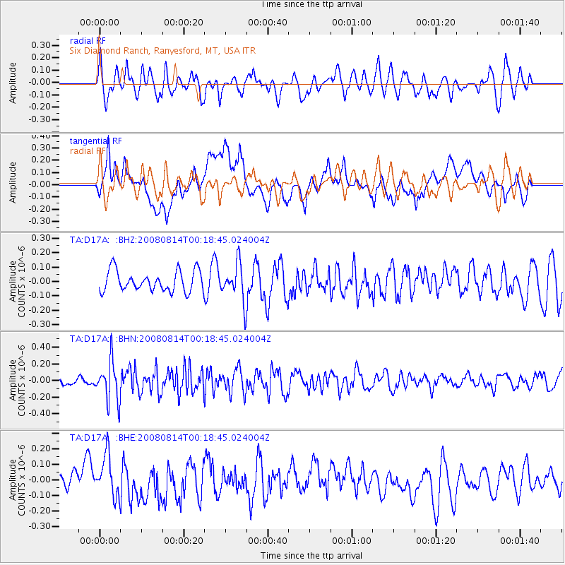
D17A Six Diamond Ranch, Ranyesford, MT, USA - Earthquake Result Viewer
*The percent match for this event was below the threshold and hence no stack was calculated.
| Earthquake location: |
Mariana Islands |
| Earthquake latitude/longitude: |
16.4/146.9 |
| Earthquake time(UTC): |
2008/08/14 (227) 00:06:40 GMT |
| Earthquake Depth: |
53 km |
| Earthquake Magnitude: |
5.5 MB, 4.8 MS |
| Earthquake Catalog/Contributor: |
WHDF/NEIC |
|
| Network: |
TA USArray Transportable Network (new EarthScope stations) |
| Station: |
D17A Six Diamond Ranch, Ranyesford, MT, USA |
| Lat/Lon: |
47.15 N/110.69 W |
| Elevation: |
1535 m |
|
| Distance: |
86.3 deg |
| Az: |
41.916 deg |
| Baz: |
290.06 deg |
| Ray Param: |
$rayparam |
*The percent match for this event was below the threshold and hence was not used in the summary stack. |
|
| Radial Match: |
62.24432 % |
| Radial Bump: |
400 |
| Transverse Match: |
57.614376 % |
| Transverse Bump: |
400 |
| SOD ConfigId: |
2504 |
| Insert Time: |
2010-03-06 11:53:36.932 +0000 |
| GWidth: |
2.5 |
| Max Bumps: |
400 |
| Tol: |
0.001 |
|
Signal To Noise
| Channel | StoN | STA | LTA |
| TA:D17A: :BHN:20080814T00:18:45.024004Z | 3.153121 | 2.441447E-7 | 7.742954E-8 |
| TA:D17A: :BHE:20080814T00:18:45.024004Z | 1.3051571 | 1.362838E-7 | 1.0441946E-7 |
| TA:D17A: :BHZ:20080814T00:18:45.024004Z | 1.8630286 | 1.3313378E-7 | 7.1460946E-8 |
| Arrivals |
| Ps | |
| PpPs | |
| PsPs/PpSs | |


